Barnard Elm Hill
Barnard Elm Hill is a residential area in Moline Township, Rock Island, Illinois. Barnard Elm Hill is situated nearby to First Congregational Church, as well as near Stephen’s Square Park.| Tap on a place to explore it |
Places of Interest Nearby
Highlights include Vibrant Arena at The MARK and John Deere Pavilion.
Vibrant Arena at The MARK
Stadium

Photo: Iowahwyman, CC BY-SA 3.0.
The Vibrant Arena at The MARK, formerly known as The MARK of the Quad Cities, the iWireless Center, and the TaxSlayer Center, is a 12,000-seat multi-purpose arena located in Moline, Illinois. Vibrant Arena at The MARK is situated 4,000 feet west of Barnard Elm Hill.
John Deere Pavilion
Museum
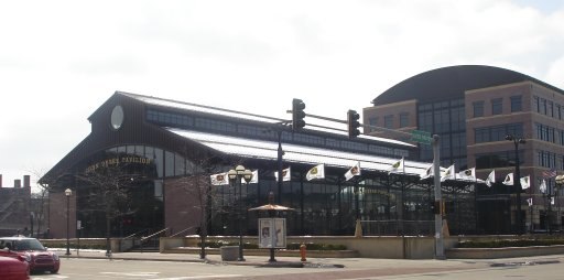
Photo: Jesster79, CC BY-SA 3.0.
The John Deere Pavilion is an attraction and museum located in Moline, Illinois. The Pavilion opened in 1997 as part of an urban renewal project on the site of the former John Deere Plow Works. John Deere Pavilion is situated 3,300 feet west of Barnard Elm Hill.
LeClaire Hotel
Building

Photo: Smallbones, CC0.
LeClaire Hotel is an historic building located in downtown Moline, Illinois, United States. It was named a Moline Historic Landmark in 1993, and it was listed on the National Register of Historic Places in 1994. LeClaire Hotel is situated 1,900 feet northwest of Barnard Elm Hill.
Places in the Area
Nearby places include Moline and Bettendorf.
Moline
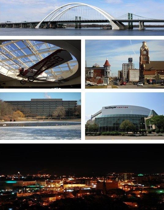
Photo: Farragutful, CC BY-SA 3.0.
Moline is one of the Quad Cities in Western Illinois. Moline's downtown serves as one of the civic and recreational hubs of the Quad Cities; many events take place at the 12,000-seat TaxSlayer Center and at John Deere Commons.
Bettendorf

Photo: Ctjf83, CC BY-SA 3.0.
Bettendorf is a city in Scott County, Iowa, United States. The population was 39,102 at the 2020 census. Bettendorf is one of the five cities that comprise the Quad Cities region along the Mississippi River.
Quad Cities

Photo: Farragutful, CC BY-SA 3.0.
The Quad Cities is a metropolitan area of five, not four, closely-entangled cities and their suburbs on either side of the Mississippi River between Iowa and Illinois. It is part of both the Western Illinois and Eastern Iowa regions.
Barnard Elm Hill
- Type: Residential area
- Location: Moline Township, Rock Island, Illinois, Midwest, United States, North America
- View on OpenStreetMap
Latitude
41.50508° or 41° 30′ 18″ northLongitude
-90.50615° or 90° 30′ 22″ westOpen location code
86HFGF4V+2GOpenStreetMap ID
way 813904469OpenStreetMap feature
landuse=residential
This page is based on OpenStreetMap, Wikidata, and Wikimedia Commons.
We’d love your help improving our open data sources. Thank you for contributing.
Satellite Map
Discover Barnard Elm Hill from above in high-definition satellite imagery.
Notable Places Nearby
Highlights include First Congregational Church and Stephen’s Square Park.
Nearby Places
Explore places such as Stephen Heights and Spalding Building.
Illinois: Must-Visit Destinations
Delve into Chicago, Springfield, Rockford, and Loop.
Curious Residential Areas to Discover
Uncover intriguing residential areas from every corner of the globe.
About Mapcarta. Data © OpenStreetMap contributors and available under the Open Database License". Text is available under the CC BY-SA 4.0 license, except for photos, directions, and the map. Photo: Rastapopulous, CC BY-SA 3.0.