Sprengerhansl
Sprengerhansl is a farm in Maria Lankowitz, Voitsberg District, Styria. Sprengerhansl is situated nearby to the church Filialkirche Gößnitz, as well as near the pitch Stocksportanlage ESV Gößnitz.| Tap on a place to explore it |
Places of Interest Nearby
Highlights include Filialkirche Gößnitz and Maria Lankowitz.
Filialkirche Gößnitz
Church

Photo: Liuthalas, CC BY-SA 4.0.
Filialkirche Gößnitz is a church, which is situated 480 metres southeast of Sprengerhansl.
Maria Lankowitz
Community center

Photo: Christian Pirkl, CC BY-SA 4.0.
Maria Lankowitz is a small market township near Köflach in the district of Voitsberg in the Austrian state of Styria, at the foot of the Stubalpe mountain. Maria Lankowitz is situated 3½ km east of Sprengerhansl.
Wallfahrtskirche Mariä Himmelfahrt
Church
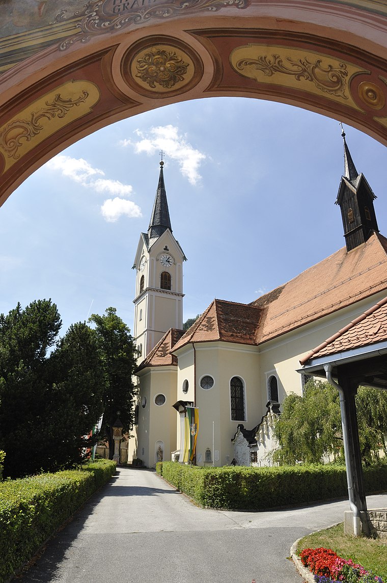
Photo: Isiwal, CC BY-SA 3.0 at.
Wallfahrtskirche Mariä Himmelfahrt is a church, which is situated 3½ km east of Sprengerhansl.
Places in the Area
Nearby places include Gößnitz and Pack.
Gößnitz
Village

Photo: Liuthalas, CC BY-SA 4.0.
Gößnitz is a former municipality in the district of Voitsberg in the Austrian state of Styria. Since the 2015 Styria municipal structural reform, it is part of the municipality Maria Lankowitz.
Pack
Village
Pack is a former municipality in the district of Voitsberg in the Austrian state of Styria. Since the 2015 Styria municipal structural reform, it is part of the municipality Hirschegg-Pack. Pack is situated 9 km south of Sprengerhansl.
Piberegg
Village
Piberegg is a former municipality in the district of Voitsberg in the Austrian state of Styria. Since the 2015 Styria municipal structural reform, it is part of the municipality Bärnbach. Piberegg is situated 9 km northeast of Sprengerhansl.
Sprengerhansl
- Type: Farm
- Category: agriculture
- Location: Maria Lankowitz, Voitsberg District, Styria, Austria, Central Europe, Europe
- View on OpenStreetMap
Latitude
47.05254° or 47° 3′ 9″ northLongitude
15.0193° or 15° 1′ 10″ eastOpen location code
8FVQ3239+2POpenStreetMap ID
way 819424295OpenStreetMap feature
landuse=farmyard
This page is based on OpenStreetMap, Wikidata, and Wikimedia Commons.
We’d love your help improving our open data sources. Thank you for contributing.
Satellite Map
Discover Sprengerhansl from above in high-definition satellite imagery.
Notable Places Nearby
Highlights include Stocksportanlage ESV Gößnitz and Kindergarten Spielplatz.
Nearby Places
Explore places such as Gemeindeamt Gößnitz and Volksschule & Kindergarten Gößnitz.
Styria: Must-Visit Destinations
Delve into Graz, Leoben, Bruck an der Mur, and Kapfenberg.
Curious Farms to Discover
Uncover intriguing farms from every corner of the globe.
About Mapcarta. Data © OpenStreetMap contributors and available under the Open Database License". Text is available under the CC BY-SA 4.0 license, except for photos, directions, and the map. Photo: Kmarka, CC BY-SA 3.0.