Laboratorio de Vigilancia y Control de la Contaminación de Palmones
Laboratorio de Vigilancia y Control de la Contaminación de Palmones is a government office in Barrios, Los, Cádiz, Andalusia. Laboratorio de Vigilancia y Control de la Contaminación de Palmones is situated nearby to the police station Puesto de Costas de Palmones, as well as near the tower Torre de Entre Rios.| Tap on a place to explore it |
Places of Interest Nearby
Highlights include Playa de Palmones and Torre de Entre Rios.
Playa de Palmones
Beach

Photo: Falconaumanni, CC BY-SA 3.0.
Playa de Palmones is a beach, which is situated 350 metres east of Laboratorio de Vigilancia y Control de la Contaminación de Palmones.
Torre de Entre Rios
Tower

Photo: Falconaumanni, CC BY 3.0.
Torre de Entre Rios is a tower, which is situated 170 metres north of Laboratorio de Vigilancia y Control de la Contaminación de Palmones.
Los Barrios power plant
Power station

Photo: Fernando Osuna, CC BY 2.0.
The Los Barrios Power Plant coal-fired power station is based on the Rankine Cycle. It is located in the municipality of Los Barrios in southern Spain, next to the Gibraltar-San Roque Refinery. Los Barrios power plant is situated 1¼ km northeast of Laboratorio de Vigilancia y Control de la Contaminación de Palmones.
Places in the Area
Nearby places include Palmones and Los Cortijillos.
Palmones
Village
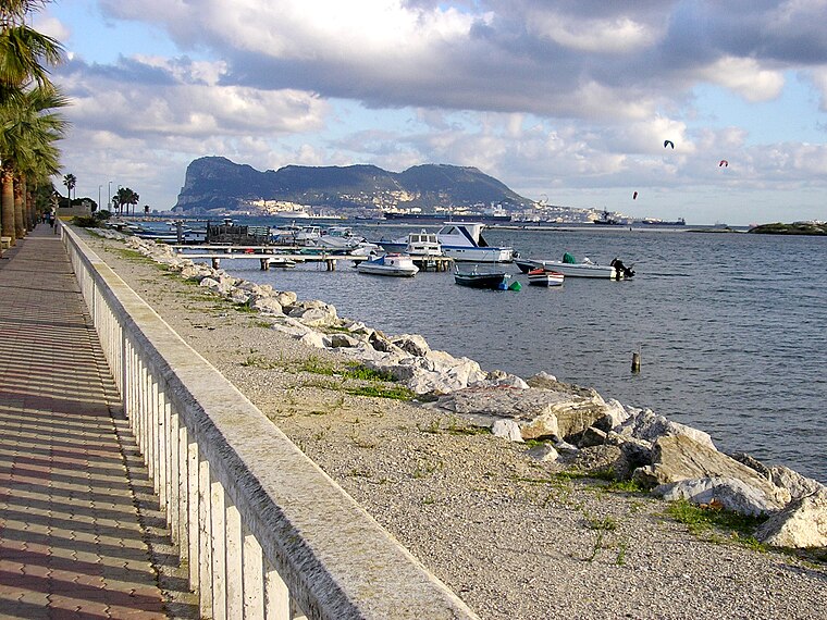
Photo: Falconaumanni, CC BY-SA 4.0.
Palmones is a village on the Bay of Gibraltar between Algeciras and La Linea de la Concepcion in the Province of Cádiz in Spain. The San Roque Refinery and Los Barrios commercial centre lie on either side of the town.
Los Cortijillos
Village

Photo: El Pantera, CC BY-SA 4.0.
Los Cortijillos is a village and district of the Spanish municipality of Los Barrios of the Province of Cádiz, Andalucia, Spain. It is located six kilometres east of the main town of the municipality, just south of Guadacorte, between Gibraltar and Algeciras.

Laboratorio de Vigilancia y Control de la Contaminación de Palmones
- Type: Government office
- Categories: building, office, and government building
- Location: Barrios, Los, Cádiz, Andalusia, Spain, Iberia, Europe
- View on OpenStreetMap
Latitude
36.17383° or 36° 10′ 26″ northLongitude
-5.43175° or 5° 25′ 54″ westOperator
Agencia de Medio Ambiente y Agua de AndalucíaOpen location code
8C8P5HF9+G8OpenStreetMap ID
way 823972504OpenStreetMap feature
building=yesOpenStreetMap feature
office=government
This page is based on OpenStreetMap, Wikidata, and Wikimedia Commons.
We’d love your help improving our open data sources. Thank you for contributing.
Satellite Map
Discover Laboratorio de Vigilancia y Control de la Contaminación de Palmones from above in high-definition satellite imagery.
Notable Places Nearby
Highlights include Puesto de Costas de Palmones and Parque de la Torre.
Nearby Places
Explore places such as Asador La Candela and El Copo.
Cádiz: Must-Visit Destinations
Delve into Cádiz, Jerez de la Frontera, Algeciras, and Tarifa.
Curious Government Offices to Discover
Uncover intriguing government offices from every corner of the globe.
About Mapcarta. Data © OpenStreetMap contributors and available under the Open Database License". Text is available under the CC BY-SA 4.0 license, except for photos, directions, and the map. Photo: Wikimedia, CC0.