NOAA Satellite Operations Facility
NOAA Satellite Operations Facility is in Prince George’s County, Capital Region, Maryland, and is located on Suitland Road. NOAA Satellite Operations Facility is situated nearby to the public building Suitland Federal Center Building #2, as well as near the pitch Lunch time Soccer.| Tap on a place to explore it |
Places of Interest Nearby
Highlights include National Maritime Intelligence-Integration Office and Smithsonian Museum Support Center.
National Maritime Intelligence-Integration Office
Office
The National Maritime Intelligence-Integration Office is a United States Navy entity which promotes and facilitates intelligence sharing between the Navy and various federal, state, and local authorities, private companies, and foreign governments. National Maritime Intelligence-Integration Office is situated 1,200 feet south of NOAA Satellite Operations Facility.
Smithsonian Museum Support Center
Museum
The Smithsonian Institution's Museum Support Center is a collections storage and conservation facility in Suitland, Maryland which houses Smithsonian collections which are not on display in the museums. Smithsonian Museum Support Center is situated 3,500 feet south of NOAA Satellite Operations Facility.
Paul E. Garber Preservation, Restoration, and Storage Facility
Museum
The Paul E. Garber Preservation, Restoration, and Storage Facility, also known colloquially as "Silver Hill", is a storage and former conservation and restoration facility of the Smithsonian National Air and Space Museum, located in Suitland, Maryland, United States. Paul E. Garber Preservation, Restoration, and Storage Facility is situated 3,900 feet southwest of NOAA Satellite Operations Facility.
Places in the Area
Nearby places include Suitland and Silver Hill.
Suitland
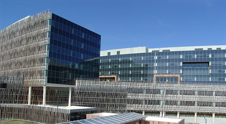
Photo: Wikimedia, Public domain.
Suitland is a census designated place in Prince George's County, Maryland. Suitland is located approximately 1 mile southeast of Washington, D.C.. As of the 2020 census, its population was 25,839.
Silver Hill
Village

Photo: Famartin, CC BY-SA 4.0.
Silver Hill is an unincorporated community and census-designated place in Prince George's County, Maryland, United States, approximately 1 mile southeast of Washington, D.C. Per the 2020 census, the population was 6,381.
Fairfax Village
Neighborhood
 Fairfax Village is a small neighborhood of garden style condominiums and townhouses located in southeast Washington, D.C. It is bounded by Alabama Avenue SE, Suitland Road SE, Pennsylvania Avenue SE, and Southern Avenue SE.
NOAA Satellite Operations Facility
- Type: Commerce
- Address: 4231 Suitland Road, Suitland, MD 20746
- Location: Prince George’s County, Capital Region, Maryland, Mid-Atlantic, United States, North America
- View on OpenStreetMap
Latitude
38.85208° or 38° 51′ 8″ northLongitude
-76.93611° or 76° 56′ 10″ westOperator
NOAAOpen location code
87C5V327+RHOpenStreetMap ID
way 824278712OpenStreetMap feature
landuse=commercial
This page is based on OpenStreetMap, Wikidata, and Wikimedia Commons.
We’d love your help improving our open data sources. Thank you for contributing.
Satellite Map
Discover NOAA Satellite Operations Facility from above in high-definition satellite imagery.
Notable Places Nearby
Highlights include Suitland Federal Center Building #2 and Lunch time Soccer.
Nearby Places
Explore places such as NOAA and Suitland Federal Center Gate 1.
Prince George’s County: Must-Visit Destinations
Delve into College Park, Bowie, Laurel, and Greenbelt.
Curious Places to Discover
Uncover intriguing places from every corner of the globe.
About Mapcarta. Data © OpenStreetMap contributors and available under the Open Database License". Text is available under the CC BY-SA 4.0 license, except for photos, directions, and the map. Photo: Wikimedia, Public domain.