Tueholthus
Tueholthus is a farm in Lejre Kommune, Region Zealand. Tueholthus is situated nearby to the village Hvalsø, as well as near Kirke Såby.| Tap on a place to explore it |
Places of Interest Nearby
Highlights include Hvalsø railway station and Kisserup Church.
Hvalsø railway station
Railway station

Photo: Dannebrog Spy, CC BY-SA 3.0.
Hvalsø railway station is a railway station serving the railway town of Kirke Hvalsø between the cities of Roskilde, Holbæk and Ringsted on the island of Zealand, Denmark. Hvalsø railway station is situated 2 km southwest of Tueholthus.
Kisserup Church
Church
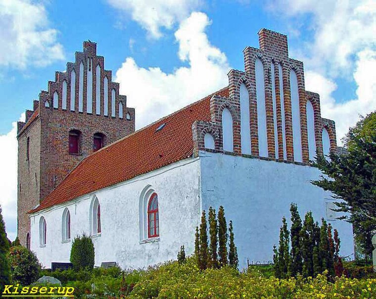
Photo: Bococo, CC BY-SA 3.0.
Kisserup Church is situated 1½ km southeast of Tueholthus.
Hvalsø Church
Church

Photo: Dannebrog Spy, CC BY-SA 4.0.
Hvalsø Church is situated 2 km southwest of Tueholthus.
Places in the Area
Nearby places include Hvalsø and Kirke Såby.
Hvalsø
Village

Photo: Bococo, CC BY-SA 3.0.
Hvalsø is a town and a former municipality in Region Sjælland on the island of Zealand in east Denmark. The former municipality covered an area of 72 km2, and had a total population of 7,856.
Kirke Såby
Village

Photo: Beethoven9, CC BY-SA 4.0.
Kirke Såby or Kirke Saaby is a small town, with a population of 1,649, in Lejre Municipality, Region Zealand in Denmark. It is located 30 km south of Frederikssund, 19 km west of Roskilde, 17 km southeast of Holbæk and 5 km north of the municipal seat Hvalsø. Kirke Såby is situated 2½ km north of Tueholthus.
Torkilstrup
Village

Photo: Beethoven9, CC BY-SA 4.0.
Torkilstrup is a village, which is situated 5 km north of Tueholthus.
Tueholthus
- Type: Farm
- Category: agriculture
- Location: Lejre Kommune, Region Zealand, Denmark, Nordic countries, Europe
- View on OpenStreetMap
Latitude
55.60921° or 55° 36′ 33″ northLongitude
11.87841° or 11° 52′ 42″ eastOpen location code
9F7HJV5H+M9OpenStreetMap ID
way 824574506OpenStreetMap feature
landuse=farmyard
This page is based on OpenStreetMap, Wikidata, and Wikimedia Commons.
We’d love your help improving our open data sources. Thank you for contributing.
Satellite Map
Discover Tueholthus from above in high-definition satellite imagery.
Notable Places Nearby
Highlights include Lejre Kommune and Skullerupholm Teglværk.
Nearby Places
Explore places such as Hammershus and Kisserup Mark.
Denmark: Must-Visit Destinations
Delve into Copenhagen, Aarhus, Odense, and Aalborg.
Curious Farms to Discover
Uncover intriguing farms from every corner of the globe.
About Mapcarta. Data © OpenStreetMap contributors and available under the Open Database License". Text is available under the CC BY-SA 4.0 license, except for photos, directions, and the map. Photo: Inkey, CC BY 2.0.