Hôtel de Ville et d’Agglomération
Hôtel de Ville et d’Agglomération is a government building in Lons-le-Saunier, Jura, Bourgogne-Franche-Comté. Hôtel de Ville et d’Agglomération is situated nearby to the public building Espace Communautaire Lons Agglomération, as well as near the town hall Mairie de Lons-le-Saunier.| Tap on a place to explore it |
- Type: Government building
- Address: 4
- Wheelchair access: yes
Places of Interest Nearby
Highlights include Thermes Lédonia and Hôtel de Balay.
Thermes Lédonia
Bathhouse
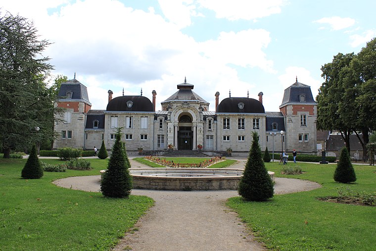
Photo: Christophe.Finot, CC BY-SA 3.0.
Thermes Lédonia is a bathhouse, which is situated 140 metres east of Hôtel de Ville et d’Agglomération.
Hôtel de Balay
Manor estate

Photo: Chabe01, CC BY-SA 4.0.
Hôtel de Balay is a manor estate, which is situated 370 metres northwest of Hôtel de Ville et d’Agglomération.
Cordeliers church
Church

Photo: Christophe.Finot, CC BY-SA 3.0.
Cordeliers church is situated 330 metres northwest of Hôtel de Ville et d’Agglomération.
Places in the Area
Nearby places include Lons-le-Saunier and Montaigu.
Lons-le-Saunier
Town

Photo: Toutaitanous, CC BY-SA 3.0.
Lons-le-Saunier is a commune and capital of the Jura Department, eastern France.
Montaigu
Village

Photo: Damsis39, CC BY-SA 4.0.
Montaigu is a commune in the Jura department in Bourgogne-Franche-Comté in eastern France.
Perrigny
Village

Photo: Gene-K, CC BY-SA 4.0.
Perrigny is a commune in the Jura department in Bourgogne-Franche-Comté in eastern France. Perrigny is an eastern suburb of Lons-le-Saunier. The Vallière forms most of the commune's south-western border.
Hôtel de Ville et d’Agglomération
- Category: building
- Location: Lons-le-Saunier, Arrondissement of Lons-le-Saunier, Jura, Bourgogne-Franche-Comté, France, Europe
- View on OpenStreetMap
Latitude
46.67193° or 46° 40′ 19″ northLongitude
5.55873° or 5° 33′ 31″ eastLevels
4Open location code
8FR7MHC5+QFOpenStreetMap ID
way 82848681OpenStreetMap feature
building=governmentOpenStreetMap attribute
wheelchair=yes
This page is based on OpenStreetMap, Wikidata, and Wikimedia Commons.
We’d love your help improving our open data sources. Thank you for contributing.
Satellite Map
Discover Hôtel de Ville et d’Agglomération from above in high-definition satellite imagery.
Notable Places Nearby
Highlights include Espace Communautaire Lons Agglomération and Mairie de Lons-le-Saunier.
Nearby Places
Explore places such as Centre Communal d’Action Sociale and Mairie - ECLA.
Bourgogne-Franche-Comté: Must-Visit Destinations
Delve into Nièvre, Dijon, Besançon, and Vesoul.
Curious Government Buildings to Discover
Uncover intriguing government buildings from every corner of the globe.
About Mapcarta. Data © OpenStreetMap contributors and available under the Open Database License". Text is available under the CC BY-SA 4.0 license, except for photos, directions, and the map. Photo: Juraastro, CC BY-SA 3.0.