Towers Garden
Towers Garden is in Nakamura Ward, Nagoya, Aichi. Towers Garden is situated nearby to the police station 中村警察署名古屋駅交番, as well as near Towers Terrace.| Tap on a place to explore it |
Places of Interest Nearby
Highlights include Nagoya Railway Station and JR Central Towers.
Nagoya Railway Station
Railway station
 Nagoya Station is a major railway station in Nakamura-ku, Nagoya, Japan. It is one of the world's largest train stations by floor area, and houses the headquarters of the Central Japan Railway Company. Nagoya Railway Station is situated 200 metres west of Towers Garden.
JR Central Towers
Shopping center
 The JR Central Towers are in Nakamura-ku in the city of Nagoya, central Japan. It is located right above Nagoya Station and serves as the headquarters of the Central Japan Railway Company. JR Central Towers is situated 100 metres northwest of Towers Garden.
Meitetsu Nagoya Station
Railway station
 Meitetsu Nagoya Station is the terminal station of the Nagoya Railroad system in Nagoya, Japan. Many trains of Meitetsu's major lines operate through this station.
Places in the Area
Nearby places include Nishiki 3-chome and Nishi Ward.
Nishiki 3-chome
Neighborhood

Photo: Akahito Yamabe, CC BY-SA 4.0.
Nishiki 3-chome is a neighborhood.
Nishi Ward
Suburb

Photo: Nagono, CC BY-SA 3.0.
Nishi-ku is one of the 16 wards in the city of Nagoya in Aichi Prefecture, Japan. As of 1 October 2019, the ward has an estimated population of 150,480 and a population density of 8,393 persons per km2. The total area is 17.93 km2.
Nagoya Castle
Locality
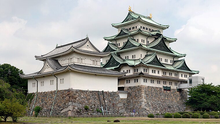
Photo: Base64, CC BY-SA 3.0.
Nagoya Castle is a Japanese castle located in Nagoya, Japan. Nagoya Castle was constructed by the Owari Domain in 1612 during the Edo period on the site of an earlier castle of the Oda clan in the Sengoku period.
Towers Garden
- Type: Pedestrian zone
- Location: Nakamura Ward, Nagoya, Aichi, Chubu, Japan, East Asia, Asia
- View on OpenStreetMap
Latitude
35.17039° or 35° 10′ 13″ northLongitude
136.88385° or 136° 53′ 2″ eastOpen location code
8Q7R5VCM+5GOpenStreetMap ID
way 835253290OpenStreetMap feature
highway=pedestrian
This page is based on OpenStreetMap, Wikidata, and Wikimedia Commons.
We’d love your help improving our open data sources. Thank you for contributing.
Satellite Map
Discover Towers Garden from above in high-definition satellite imagery.
Notable Places Nearby
Highlights include 中村警察署名古屋駅交番 and Towers Terrace.
Nearby Places
Explore places such as Yakiniku Toraji and Starbucks.
Aichi: Must-Visit Destinations
Delve into Toyota, Toyohashi, Okazaki, and Ichinomiya.
Curious Places to Discover
Uncover intriguing places from every corner of the globe.
About Mapcarta. Data © OpenStreetMap contributors and available under the Open Database License". Text is available under the CC BY-SA 4.0 license, except for photos, directions, and the map. Photo: AndreCarrotflower, CC BY-SA 3.0.