Gfalu
Gfalu is an office building in Avignon, Vaucluse, Provence-Alpes-Côte d’Azur. Gfalu is situated nearby to the community center Salle des Fêtes La Colombe, as well as near the school École primaire Courtine.| Tap on a place to explore it |
Places of Interest Nearby
Highlights include Pont Saint-Bénézet and Avignon TGV station.
Pont Saint-Bénézet

Photo: Chimigi, CC BY-SA 2.0 fr.
The Pont Saint-Bénézet, also known as the Pont d'Avignon, was a medieval bridge across the Rhône in the town of Avignon, in southern France. Only four arches survive. Pont Saint-Bénézet is situated 3½ km northeast of Gfalu.
Avignon TGV station
Railway stop

Photo: Véronique PAGNIER, Public domain.
Avignon TGV is a railway station located in Avignon, France. It was opened on 10 June 2001 and is located on the LGV Méditerranée high-speed line and Avignon-Centre–Avignon TGV railway. Avignon TGV station is situated 1¼ km southeast of Gfalu.
Fabrica
Theater building

Photo: Marianne Casamance, CC BY-SA 4.0.
Fabrica is a theater building, which is situated 2 km east of Gfalu.
Places in the Area
Nearby places include Ile Piot and Villeneuve-lès-Avignon.
Ile Piot
Locality

Photo: Txllxt TxllxT, CC BY-SA 4.0.
Ile Piot is a locality, which is situated 2½ km northeast of Gfalu.
Villeneuve-lès-Avignon
Town
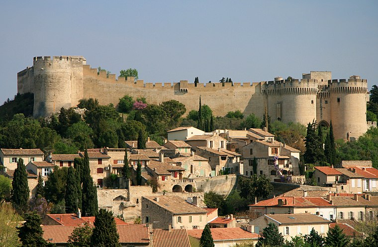
Photo: Luu, CC BY-SA 3.0.
Villeneuve-lès-Avignon is a commune in the Gard department in southern France. It can also be spelled Villeneuve-lez-Avignon. Villeneuve-lès-Avignon is situated 4 km northeast of Gfalu.
Rognonas
Village
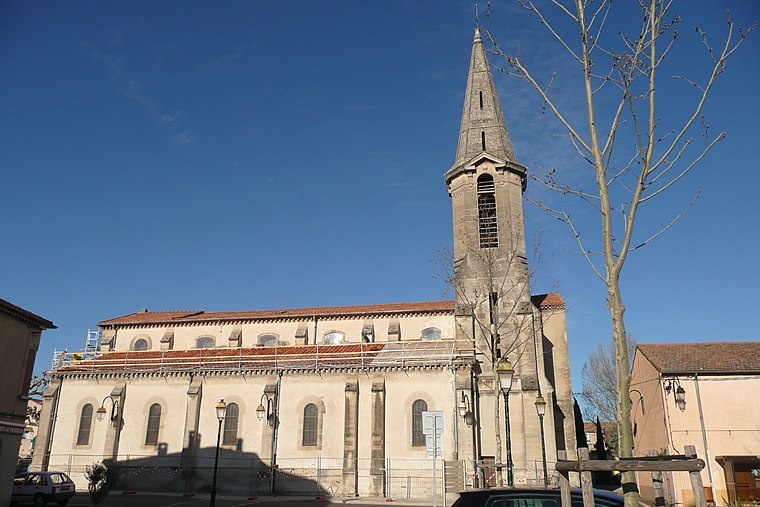
Photo: Wikimedia, CC BY-SA 3.0.
Rognonas is a commune in the Bouches-du-Rhône department in southern France. Rognonas is situated 4 km southeast of Gfalu.
Gfalu
- Type: Office building
- Categories: building and office
- Location: Avignon, Arrondissement of Avignon, Vaucluse, Provence-Alpes-Côte d’Azur, France, Europe
- View on OpenStreetMap
Latitude
43.93065° or 43° 55′ 50″ northLongitude
4.77519° or 4° 46′ 31″ eastOpen location code
8FM6WQJG+73OpenStreetMap ID
way 83748931OpenStreetMap feature
building=office
This page is based on OpenStreetMap, Wikidata, and Wikimedia Commons.
We’d love your help improving our open data sources. Thank you for contributing.
Satellite Map
Discover Gfalu from above in high-definition satellite imagery.
Places with the Same Name
Discover other places named “Gfalu”.
Notable Places Nearby
Highlights include Salle des Fêtes La Colombe and École primaire Courtine.
Nearby Places
Explore places such as Aquila and GTN.
Vaucluse: Must-Visit Destinations
Delve into Orange, Carpentras, Cavaillon, and Gordes.
Curious Office Buildings to Discover
Uncover intriguing office buildings from every corner of the globe.
About Mapcarta. Data © OpenStreetMap contributors and available under the Open Database License". Text is available under the CC BY-SA 4.0 license, except for photos, directions, and the map. Photo: Brateevsky, CC BY-SA 3.0.