Велика Плана
Велика Плана is a bus station in Opština Velika Plana, Podunavlje District, Central Serbia. Велика Плана is situated nearby to the marketplace Градска пијаца, as well as near the courthouse Основни суд у Великој Плани.| Tap on a place to explore it |
Places of Interest Nearby
Highlights include Crkva Sv. Vartolomeja i Varnave (Velika Plana) and Monastery Pokajnica.
Crkva Sv. Vartolomeja i Varnave (Velika Plana)
Church

Photo: Ванилица, CC BY-SA 4.0.
Crkva Sv. Vartolomeja i Varnave (Velika Plana) is a church, which is situated 1 km west of Велика Плана.
Monastery Pokajnica
Monastery
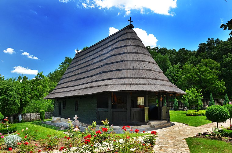
Photo: Sstruja, CC BY-SA 3.0.
The Pokajnica Monastery is a monastery complex in Velika Plana, Serbia. Monastery Pokajnica is situated 3½ km southwest of Велика Плана.
Црква Свете Петке
Church

Photo: Mefisto822, CC BY-SA 3.0.
Црква Свете Петке is a church, which is situated 3½ km north of Велика Плана.
Places in the Area
Nearby places include Velika Plana and Veliko Orašje.
Velika Plana
Town

Photo: Wikimedia, CC BY 3.0 rs.
Velika Plana is a town and municipality located in the Podunavlje District of Serbia. As of 2022, the town has 14,609 inhabitants, while the municipality has 35,451. Velika Plana lies on the left bank of Velika Morava.
Veliko Orašje
Village
Photo: Mefisto822, CC BY-SA 3.0.
Veliko Orašje is a village in the municipality of Velika Plana, Serbia. According to the 2002 census, the village has a population of 2299 people. Veliko Orašje is situated 4 km north of Велика Плана.
Staro Selo
Village

Photo: Sstruja, CC BY-SA 3.0.
Staro Selo is a small town in the municipality of Velika Plana, Serbia. According to the 2002 census, the town has a population of 3022 people. Staro Selo is situated 5 km southeast of Велика Плана.
Велика Плана
- Type: Bus station
- Also known as: “Velika Plana”
- Categories: station and transportation
- Location: Opština Velika Plana, Podunavlje District, Central Serbia, Serbia, Balkans, Europe
- View on OpenStreetMap
Latitude
44.33663° or 44° 20′ 12″ northLongitude
21.07677° or 21° 4′ 36″ eastOpen location code
8GP383PG+MPOpenStreetMap ID
way 837945360OpenStreetMap feature
amenity=bus_stationOpenStreetMap feature
public_transport=station
This page is based on OpenStreetMap, Wikidata, and Wikimedia Commons.
We’d love your help improving our open data sources. Thank you for contributing.
Satellite Map
Discover Велика Плана from above in high-definition satellite imagery.
Places with the Same Name
Discover other places named “Велика Плана”.
Notable Places Nearby
Highlights include Old cemetery in Velika Plana and 11320 Велика Плана.
Nearby Places
Explore places such as Buki and Велика Плана.
Serbia: Must-Visit Destinations
Delve into Belgrade, Novi Sad, Niš, and Kragujevac.
Curious Bus Stations to Discover
Uncover intriguing bus stations from every corner of the globe.
About Mapcarta. Data © OpenStreetMap contributors and available under the Open Database License". Text is available under the CC BY-SA 4.0 license, except for photos, directions, and the map. Photo: Lošmi, CC BY-SA 3.0.