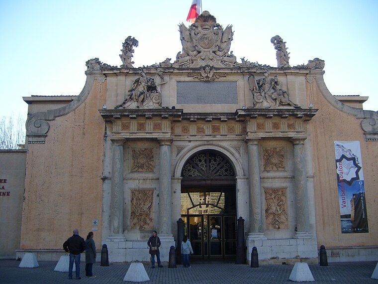
Préfecture maritime de la Méditerranée
Préfecture maritime de la Méditerranée is a public building in Toulon, Var, Provence-Alpes-Côte d’Azur. Préfecture maritime de la Méditerranée is situated nearby to National Maritime Museum, as well as near the square Place Ingénieur Monsenergue.| Tap on a place to explore it |
Places of Interest Nearby
Highlights include National Maritime Museum and Église Saint-Louis de Toulon.
Église Saint-Louis de Toulon
Church

Photo: Rvalette, CC BY-SA 3.0.
Église Saint-Louis de Toulon is a church, which is situated 260 metres northeast of Préfecture maritime de la Méditerranée.
Hôtel de Ville, Toulon
Town hall

Photo: Chabe01, CC BY-SA 4.0.
The Hôtel de Ville is a historic building in Toulon, Var, southern France, standing on Avenue de la République. Hôtel de Ville, Toulon is situated 350 metres east of Préfecture maritime de la Méditerranée.
Places in the Area
Nearby places include Basse Ville and Le Mourillon.

Le Mourillon
Suburb

Photo: Maisrimer, Public domain.
Le Mourillon is a neighbourhood to the east of the French city of Toulon, near the entrance to the Rade or roadstead. It was once a fishing village, and then became the home of many of the officers of the French fleet and to part of the naval dockyard.
Cap Brun
Suburb

Photo: Adltbc92, CC BY-SA 3.0.
Cap Brun is a suburb, which is situated 3½ km east of Préfecture maritime de la Méditerranée.
Préfecture maritime de la Méditerranée
- Type: Public building
- Also known as: “Premar Méditerranée”
- Categories: government office, building, office, and government building
- Location: Toulon, Arrondissement of Toulon, Var, Provence-Alpes-Côte d’Azur, France, Europe
- View on OpenStreetMap
Latitude
43.12128° or 43° 7′ 17″ northLongitude
5.92843° or 5° 55′ 42″ eastOpen location code
8FM74WCH+G9OpenStreetMap ID
way 842473304OpenStreetMap feature
building=publicOpenStreetMap feature
office=government
This page is based on OpenStreetMap, Wikidata, and Wikimedia Commons.
We’d love your help improving our open data sources. Thank you for contributing.
Satellite Map
Discover Préfecture maritime de la Méditerranée from above in high-definition satellite imagery.
Notable Places Nearby
Highlights include Place Ingénieur Monsenergue and Gendarmerie maritime.
Nearby Places
Explore places such as Préfecture Maritime and Porte Principale.
Var: Must-Visit Destinations
Delve into Saint-Tropez, Hyères, Fréjus, and Saint-Raphaël.
Curious Public Buildings to Discover
Uncover intriguing public buildings from every corner of the globe.
About Mapcarta. Data © OpenStreetMap contributors and available under the Open Database License". Text is available under the CC BY-SA 4.0 license, except for photos, directions, and the map. Photo: yves Tennevin, CC BY 2.0.