Urbanización Marina Playa
Urbanización Marina Playa is a residential area in Noja, Cantabria. Urbanización Marina Playa is situated nearby to the manor estate Palacio del Marqués de Albaicín, as well as near the post office Oficina de Correos.| Tap on a place to explore it |
Places of Interest Nearby
Highlights include Palacio del Marqués de Albaicín and Playa de Tregandín.
Palacio del Marqués de Albaicín
Park
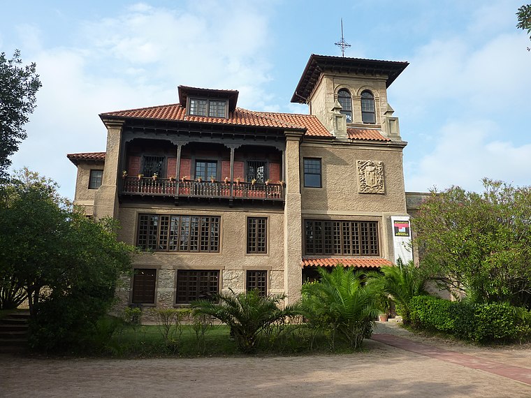
Photo: AVANTI, CC BY-SA 3.0.
Palacio del Marqués de Albaicín is a park.
Playa de Tregandín
Beach

Photo: P. B. Obregón, CC BY-SA 4.0.
Playa de Tregandín is a beach, which is situated 1 km southeast of Urbanización Marina Playa.
Playa de Ris
Beach

Photo: Discasto, CC BY-SA 4.0.
Playa de Ris is a beach, which is situated 1¼ km northwest of Urbanización Marina Playa.
Places in the Area
Nearby places include Noja and Soano.
Noja
Village

Photo: Xuankar, CC BY-SA 3.0.
Noja is a municipality located in the autonomous community of Cantabria, Spain. It has 2 beaches, "Trengandin" and "Ris".

Castillo
Village

Photo: Sannicolasdeugarte, CC BY-SA 3.0.
Castillo is a village, which is situated 3 km southwest of Urbanización Marina Playa.
Urbanización Marina Playa
- Type: Residential area
- Location: Noja, Cantabria, Green Spain, Spain, Iberia, Europe
- View on OpenStreetMap
Latitude
43.48318° or 43° 28′ 59″ northLongitude
-3.52091° or 3° 31′ 15″ westOpen location code
8CMRFFMH+7JOpenStreetMap ID
way 844406054OpenStreetMap feature
landuse=residential
This page is based on OpenStreetMap, Wikidata, and Wikimedia Commons.
We’d love your help improving our open data sources. Thank you for contributing.
Satellite Map
Discover Urbanización Marina Playa from above in high-definition satellite imagery.
Notable Places Nearby
Highlights include Palacio del Marqués de Albaicín and Oficina de Correos.
Nearby Places
Explore places such as Jardín de bonsais and Nomada.
Cantabria: Must-Visit Destinations
Delve into Santander, Santillana del Mar, Castro Urdiales, and Valles Pasiegos.
Curious Residential Areas to Discover
Uncover intriguing residential areas from every corner of the globe.
About Mapcarta. Data © OpenStreetMap contributors and available under the Open Database License". Text is available under the CC BY-SA 4.0 license, except for photos, directions, and the map. Photo: Adbar, CC BY-SA 3.0.