Landi Kornturm
Landi Kornturm is a warehouse in Wichtrach, Bern-Mittelland, Canton of Bern which is located on Seilereistrasse. Landi Kornturm is situated nearby to the fire station Feuerwehrmagazin, as well as near the town hall Gemeindeverwaltung.| Tap on a place to explore it |
Places of Interest Nearby
Highlights include Wichtrach railway station and New château.
Wichtrach railway station
Railway station
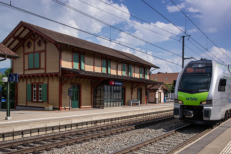
Photo: WillYs Fotowerkstatt, CC BY-SA 3.0.
Wichtrach railway station is a railway station in the municipality of Wichtrach, in the Swiss canton of Bern. It is an intermediate stop on the standard gauge Bern–Thun line of Swiss Federal Railways. Wichtrach railway station is situated 350 metres south of Landi Kornturm.
New château
Castle

Photo: Mike Switzerland, CC BY-SA 3.0.
New château is a castle, which is situated 1½ km west of Landi Kornturm.
Old château
Castle

Photo: Funck77, CC BY-SA 3.0.
Old château is a castle, which is situated 2 km west of Landi Kornturm.
Places in the Area
Nearby places include Gerzensee and Mühledorf.
Gerzensee
Village

Photo: Robert Scarth, CC BY-SA 2.0.
Gerzensee is a municipality in the Bern-Mittelland administrative district in the canton of Bern in Switzerland. The town is named after its lake, Gerzensee.
Mühledorf
Village

Photo: WillYs Fotowerkstatt, CC BY 3.0.
Mühledorf is a former municipality in the Bern-Mittelland administrative district in the canton of Bern in Switzerland. On 1 January 2018 the former municipalities of Gelterfingen, Mühledorf and Noflen merged into the municipality of Kirchdorf. Mühledorf is situated 3 km southwest of Landi Kornturm.
Jaberg
Village
Jaberg is a municipality in the Bern-Mittelland administrative district in the canton of Bern in Switzerland. Jaberg is situated 3 km south of Landi Kornturm.
Landi Kornturm
- Type: Warehouse
- Address: Seilereistrasse 20, Wichtrach, 3114
- Category: building
- Location: Wichtrach, Bern-Mittelland, Canton of Bern, Switzerland, Central Europe, Europe
- View on OpenStreetMap
Latitude
46.84469° or 46° 50′ 41″ northLongitude
7.56816° or 7° 34′ 5″ eastLevels
25Height
50 metres (164 feet)Open location code
8FR9RHV9+V7OpenStreetMap ID
way 845125691OpenStreetMap feature
building=warehouse
This page is based on OpenStreetMap, Wikidata, and Wikimedia Commons.
We’d love your help improving our open data sources. Thank you for contributing.
Satellite Map
Discover Landi Kornturm from above in high-definition satellite imagery.
Notable Places Nearby
Highlights include Feuerwehrmagazin and Gemeindeverwaltung.
Nearby Places
Explore places such as Landi and Schulhaus und Kindergarten Stadelfeld.
Switzerland: Must-Visit Destinations
Delve into Zurich, Berne, Geneva, and Basel.
Curious Warehouses to Discover
Uncover intriguing warehouses from every corner of the globe.
About Mapcarta. Data © OpenStreetMap contributors and available under the Open Database License". Text is available under the CC BY-SA 4.0 license, except for photos, directions, and the map. Photo: Simonizer, CC BY-SA 2.0 de.