Robbins Farm Playground
Robbins Farm Playground is in Town of Arlington, Middlesex, Massachusetts. Robbins Farm Playground is situated nearby to Robbins Farm Park, as well as near the water tower Arlington Reservoir.| Tap on a place to explore it |
- Opening hours: sunrise—sunset
- Type: Construction
- Wheelchair access: yes
Places of Interest Nearby
Highlights include Boston Massachusetts Temple and Arlington Reservoir.
Boston Massachusetts Temple
Church
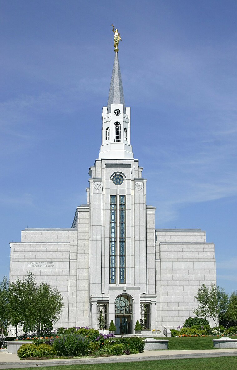
Photo: Sesmith, Public domain.
The Boston Massachusetts Temple is the 100th operating temple of the Church of Jesus Christ of Latter-day Saints. The intent to build the temple was announced on September 30, 1995, by church president Gordon B. Boston Massachusetts Temple is situated 3,500 feet west of Robbins Farm Playground.
Arlington Reservoir
Water tower

Photo: Daderot, Public domain.
The Arlington Reservoir water tower is a large water storage tank located on Park Circle in Arlington, Massachusetts. It was constructed by the Metropolitan Water Works between 1921 and 1924 in the Classical Revival style, to provide water storage for Northern Extra-High Service area, consisting of Lexington and the higher elevations of Belmont and Arlington. Arlington Reservoir is situated 1,500 feet northwest of Robbins Farm Playground.
Old Schwamb Mill
Museum

Photo: Tim Pierce, CC BY 3.0.
The Old Schwamb Mill is an historic 19th-century mill at 17 Mill Lane in Arlington, Massachusetts. It claims to be located on the oldest continuously-used mill site in the United States, with a documented history of operation dating back to about 1684. Old Schwamb Mill is situated 1 mile north of Robbins Farm Playground.
Places in the Area
Nearby places include Peirce Farm Historic District and Kensington Park Historic District.
Peirce Farm Historic District
Neighborhood

Photo: Magicpiano, CC BY-SA 4.0.
The Peirce Farm Historic District is a small historic district within the Arlington Heights neighborhood of the town of Arlington, Massachusetts. The district features three houses that are in a transitional style between Federal and Greek Revival styles, dating from the 1830s.
Kensington Park Historic District
Neighborhood

Photo: Daderot, Public domain.
The Kensington Park Historic District of Arlington, Massachusetts encompasses a turn of the 20th century planned residential subdivision in the hills above the town center, representing an early phase in the town's transition from a rural to suburban setting.
Arlington
 Arlington is a town of 46,000 people in Massachusetts. It is a largely residential town; many of its residents are employed in Cambridge, Boston and surrounding towns.
Robbins Farm Playground
Latitude
42.41284° or 42° 24′ 46″ northLongitude
-71.17534° or 71° 10′ 31″ westOperator
Town of ArlingtonOpen location code
87JCCR7F+4VOpenStreetMap ID
way 847331410OpenStreetMap feature
landuse=constructionOpenStreetMap attribute
wheelchair=yes
This page is based on OpenStreetMap, Wikidata, and Wikimedia Commons.
We’d love your help improving our open data sources. Thank you for contributing.
Satellite Map
Discover Robbins Farm Playground from above in high-definition satellite imagery.
Notable Places Nearby
Highlights include Robbins Farm Park and Park Circle.
Nearby Places
Explore places such as Robbins Farm Garden and Dog Statue.
Massachusetts: Must-Visit Destinations
Delve into Boston, Cambridge, Springfield, and Downtown Boston.
Curious Places to Discover
Uncover intriguing places from every corner of the globe.
About Mapcarta. Data © OpenStreetMap contributors and available under the Open Database License". Text is available under the CC BY-SA 4.0 license, except for photos, directions, and the map. Photo: papadunes, CC BY-SA 3.0.