Oak Acres
Oak Acres is a residential area in Clackamas, Oregon which is located on Southeast Highway 212. Oak Acres is situated nearby to the military installation Camp Withycombe, as well as near the suburb Clackamas.| Tap on a place to explore it |
Places of Interest Nearby
Highlights include Oregon Military Museum and Mount Talbert.
Oregon Military Museum
Museum
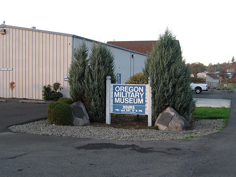
Photo: Wikimedia, CC BY-SA 3.0.
The Oregon Military Museum at Camp Withycombe in Clackamas County, Oregon, is a museum of Oregon's military heritage including the Oregon National Guard, the state's early militias, and all branches of the US Armed Forces. Oregon Military Museum is situated 2,100 feet west of Oak Acres.
Mount Talbert
Peak

Photo: Esprqii, CC BY-SA 3.0.
Mount Talbert is a volcanic cinder cone in Clackamas County, Oregon. It is part of the Boring Lava Field, a zone of ancient volcanic activity in the area around Portland.
Clackamas High School
School

Photo: Aboutmovies, CC BY 3.0.
Clackamas High School is a public high school located in Clackamas, Oregon. It is the second oldest of the four high schools in the North Clackamas School District. Clackamas High School is situated 1 mile northeast of Oak Acres.
Places in the Area
Nearby places include Clackamas and Johnson City.
Clackamas
Suburb

Photo: Visitor7, CC BY-SA 3.0.
Clackamas is an unincorporated community and former census-designated place in Clackamas County, Oregon, United States, and is a suburb of Portland. The population was approximately 7,000 as of 2010.
Johnson City
Village

Photo: Visitor7, CC BY-SA 3.0.
Johnson City is a city in Clackamas County, Oregon, United States. The population was 566 at the 2010 census. Because of its small area, its population density is over 8,000 per square mile, making it the most densely populated city in Oregon.
Oatfield
Suburb
Oatfield is an unincorporated community and census-designated place in Clackamas County, Oregon, United States. It is in the Portland metropolitan area. Oatfield is situated 2 miles west of Oak Acres.
Oak Acres
- Type: Residential area
- Address: 10701 Southeast Highway 212, Clackamas, 97015
- Location: Clackamas, Oregon, Pacific Northwest, United States, North America
- View on OpenStreetMap
Latitude
45.40972° or 45° 24′ 35″ northLongitude
-122.55179° or 122° 33′ 6″ westOpen location code
84QVCC5X+V7OpenStreetMap ID
way 848653896OpenStreetMap feature
landuse=residential
This page is based on OpenStreetMap, Wikidata, and Wikimedia Commons.
We’d love your help improving our open data sources. Thank you for contributing.
Satellite Map
Discover Oak Acres from above in high-definition satellite imagery.
Places with the Same Name
Discover other places named “Oak Acres”.
Notable Places Nearby
Highlights include Camp Withycombe and Northwest Sand & Gravel.
Nearby Places
Explore places such as 10700 Block Southeast Highway 212 and 10800 Block Southeast Highway 212.
Oregon: Must-Visit Destinations
Delve into Portland, Salem, Eugene, and Beaverton.
Curious Residential Areas to Discover
Uncover intriguing residential areas from every corner of the globe.
About Mapcarta. Data © OpenStreetMap contributors and available under the Open Database License". Text is available under the CC BY-SA 4.0 license, except for photos, directions, and the map. Photo: Wikimedia, CC BY-SA 3.0.