cooperatives agro-alimentàries
cooperatives agro-alimentàries is a farm shop in Santa Maria del Camí, Balearic Islands. cooperatives agro-alimentàries is situated nearby to the power station Parc Solar del SFM, as well as near the pitch Pàdel Box.| Tap on a place to explore it |
Places of Interest Nearby
Highlights include Son Llaüt and Santa Maria del Camí town hall.
Son Llaüt
Public building

Photo: Rotget, CC BY-SA 3.0.
Son Llaüt is a public building, which is situated 470 metres south of cooperatives agro-alimentàries.
Santa Maria del Camí town hall
Town hall
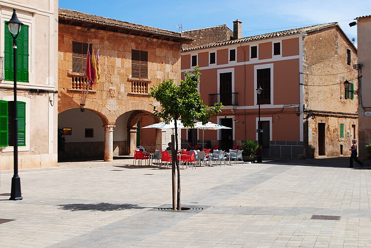
Photo: Rotget, CC BY-SA 3.0.
Santa Maria del Camí town hall is situated 1½ km southwest of cooperatives agro-alimentàries.
Santa Maria del Camí train station
Railway station

Photo: Wikimedia, CC BY-SA 3.0.
Santa Maria del Camí train station is a railway station, which is situated 1½ km west of cooperatives agro-alimentàries.
Places in the Area
Nearby places include Consell and Son Seguí de Passatemps.
Consell
Village

Photo: Aracelifoto, CC BY-SA 3.0.
Consell is a small municipality in the district of Raiguer on Majorca, one of the Balearic Islands, Spain.
Son Seguí de Passatemps
Locality

Photo: Rotget, CC BY-SA 3.0.
Son Seguí de Passatemps is a locality, which is situated 3½ km southeast of cooperatives agro-alimentàries.
Alaró

Photo: David de Mallorca, CC BY 2.0.
Alaró is a small town in the Raiguer region of Mallorca. It's nowadays a commuter town for the capital Palma, with a population in 2024 of 6100. Its main attraction is the mountain-top castle.
cooperatives agro-alimentàries
- Type: Farm shop
- Categories: building, shop, and food
- Location: Santa Maria del Camí, Balearic Islands, Spain, Iberia, Europe
- View on OpenStreetMap
Latitude
39.65822° or 39° 39′ 30″ northLongitude
2.79094° or 2° 47′ 27″ eastOpen location code
8FF4MQ5R+79OpenStreetMap ID
way 84948423OpenStreetMap feature
building=yesOpenStreetMap feature
shop=farm
This page is based on OpenStreetMap, Wikidata, and Wikimedia Commons.
We’d love your help improving our open data sources. Thank you for contributing.
Satellite Map
Discover cooperatives agro-alimentàries from above in high-definition satellite imagery.
Notable Places Nearby
Highlights include Parc Solar del SFM and Pàdel Box.
Nearby Places
Explore places such as Mercedes-Benz and Pisciten.
Balearic Islands: Must-Visit Destinations
Delve into Palma de Mallorca, Formentera, Ibiza, and Maó.
Curious Farm Shops to Discover
Uncover intriguing farm shops from every corner of the globe.
About Mapcarta. Data © OpenStreetMap contributors and available under the Open Database License". Text is available under the CC BY-SA 4.0 license, except for photos, directions, and the map. Photo: anieto2k, CC BY-SA 2.0.