Meilihof
Meilihof is a social service facility in Hausen am Albis, Affoltern District, Canton of Zurich. Meilihof is situated nearby to the fountain Dorfbrunnen, as well as near the playground Spielplatz Ebertswil.| Tap on a place to explore it |
Places of Interest Nearby
Highlights include Kappel Abbey and Reformed church.
Kappel Abbey
Church

Photo: Wikimedia, CC BY-SA 3.0.
Kappel Abbey is a former Cistercian monks monastery located in Kappel am Albis in the Swiss canton of Zurich. Kappel Abbey is situated 2 km west of Meilihof.
Reformed church
Church

Photo: Michael D. Schmid, CC BY-SA 4.0.
Reformed church is situated 2 km northwest of Meilihof.
Herz Jesu Hausen Albis
Church

Photo: Charly Bernasconi, CC BY-SA 4.0.
Herz Jesu Hausen Albis is a church, which is situated 2 km northwest of Meilihof.
Places in the Area
Nearby places include Kappel am Albis and Sihlbrugg.
Kappel am Albis
Village

Photo: Schulerst, CC BY-SA 3.0.
Kappel am Albis is a municipality in the district of Affoltern in the canton of Zürich in Switzerland. Its name of Kappel is specified by "on the Albis" to distinguish it from two other villages called Kappel in Switzerland.
Sihlbrugg
Village
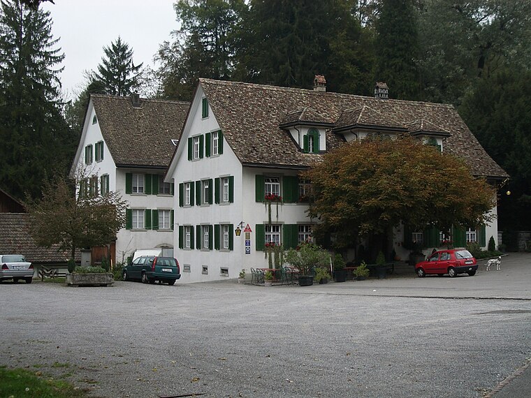
Photo: Paebi, CC BY-SA 3.0.
Sihlbrugg is a village and important transportation node between the cantons of Zug and Zürich in Switzerland.
Neuheim
Village
Photo: Ikiwaner, CC BY-SA 3.0.
Neuheim is a municipality in the canton of Zug in Switzerland. Neuheim is situated 3½ km southeast of Meilihof.
Meilihof
Latitude
47.2281° or 47° 13′ 41″ northLongitude
8.54932° or 8° 32′ 58″ eastOpen location code
8FVC6GHX+6POpenStreetMap ID
way 850087521OpenStreetMap feature
amenity=social_facility
This page is based on OpenStreetMap, Wikidata, and Wikimedia Commons.
We’d love your help improving our open data sources. Thank you for contributing.
Satellite Map
Discover Meilihof from above in high-definition satellite imagery.
Notable Places Nearby
Highlights include Dorfbrunnen and Spielplatz Ebertswil.
Nearby Places
Explore places such as Hofkaffee Meilihof and Wohnhuus Meilihof.
Switzerland: Must-Visit Destinations
Delve into Zurich, Berne, Geneva, and Basel.
Curious Social Service Facilities to Discover
Uncover intriguing social service facilities from every corner of the globe.
About Mapcarta. Data © OpenStreetMap contributors and available under the Open Database License". Text is available under the CC BY-SA 4.0 license, except for photos, directions, and the map. Photo: Roland zh, CC BY-SA 3.0.