Getränke von A bis Z
Getränke von A bis Z is a beverage shop in Torgelow, Vorpommern-Greifswald, Mecklenburg-Western Pomerania. Getränke von A bis Z is situated nearby to the church Christuskirche (Torgelow), as well as near the town hall Rathaus Torgelow.| Tap on a place to explore it |
Places of Interest Nearby
Highlights include Christuskirche (Torgelow) and Burg Torgelow.
Christuskirche (Torgelow)
Church

Photo: Mathes1984, CC BY-SA 3.0.
Christuskirche (Torgelow) is a church.
Burg Torgelow
Castle
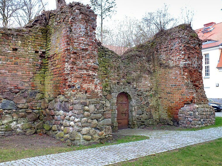
Photo: Mathes1984, CC BY-SA 3.0.
Burg Torgelow is a castle, which is situated 230 metres east of Getränke von A bis Z.
Torgelow station
Railway station

Photo: Mathes1984, CC BY-SA 3.0.
Torgelow is a railway station in the town of Torgelow, Mecklenburg-Vorpommern, Germany. The station lies on the Jatznick–Ueckermünde railway line and the train services are operated by DB Regio Nordost. Torgelow station is situated 560 metres north of Getränke von A bis Z.
Places in the Area
Nearby places include Torgelow and Hammer an der Uecker.
Torgelow
Town
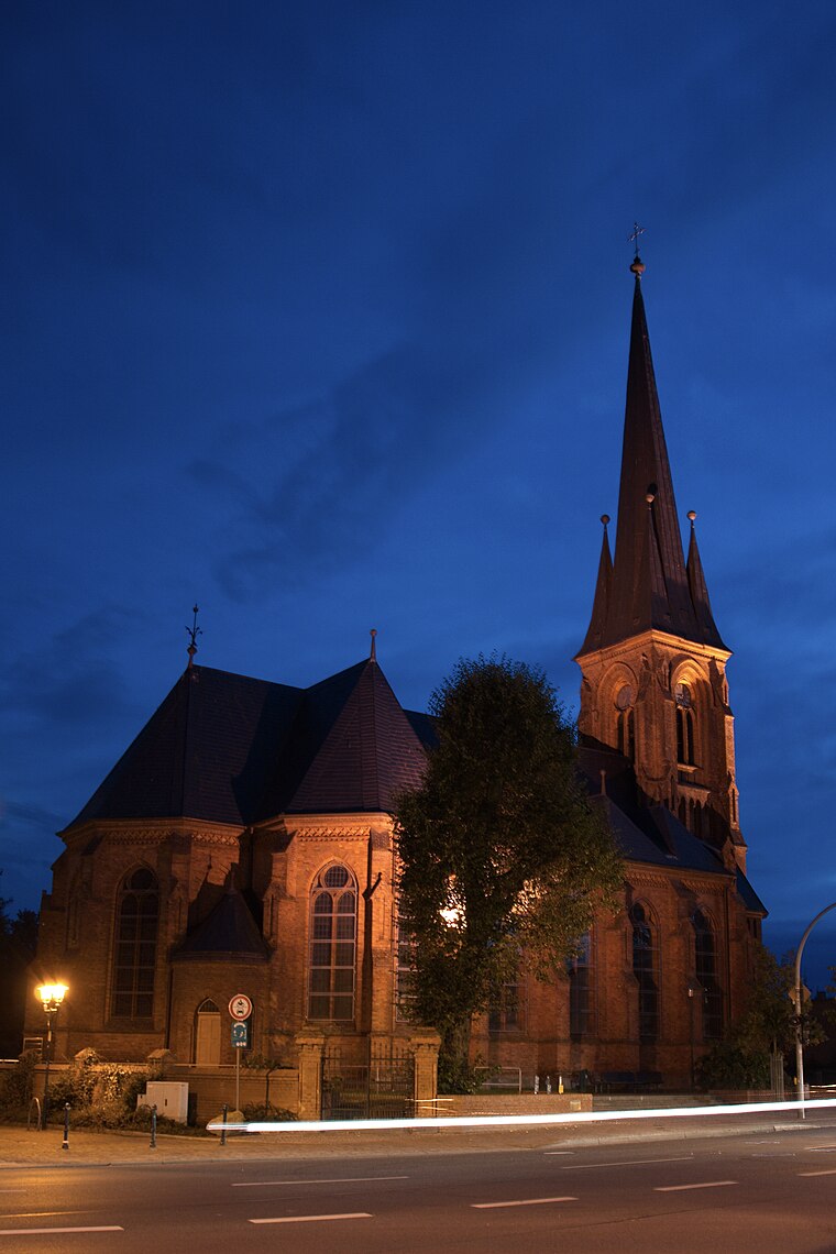
Photo: Mathes1984, CC BY-SA 3.0.
Torgelow is a municipality in the Vorpommern-Greifswald district, in Mecklenburg-Western Pomerania in north-eastern Germany. It is situated on the river Uecker, 12 km south of Ueckermünde, and 41 km northwest of Szczecin, Poland.
Hammer an der Uecker
Village

Photo: Global Fish, CC BY-SA 4.0.
Hammer an der Uecker is a municipality in the Vorpommern-Greifswald district, in Mecklenburg-Vorpommern, Germany. The eponymous Uecker is a proximate river. Hammer an der Uecker is situated 4 km southwest of Getränke von A bis Z.
Stallberg
Hamlet

Photo: Wikimedia, CC BY-SA 3.0.
Stallberg is a hamlet, which is situated 6 km south of Getränke von A bis Z.
Getränke von A bis Z
- Type: Beverage shop
- Categories: building, shop, and retail building
- Location: Torgelow, Vorpommern-Greifswald, Mecklenburg-Western Pomerania, Germany, Central Europe, Europe
- View on OpenStreetMap
Latitude
53.62956° or 53° 37′ 46″ northLongitude
14.00968° or 14° 0′ 35″ eastOpen location code
9F5PJ2H5+RVOpenStreetMap ID
way 85055105OpenStreetMap feature
building=retailOpenStreetMap feature
shop=beverages
This page is based on OpenStreetMap, Wikidata, and Wikimedia Commons.
We’d love your help improving our open data sources. Thank you for contributing.
Satellite Map
Discover Getränke von A bis Z from above in high-definition satellite imagery.
Notable Places Nearby
Highlights include Rathaus Torgelow and Ueckersaal.
Nearby Places
Explore places such as Pofahl and Kebap-Haus.
Mecklenburg-Western Pomerania: Must-Visit Destinations
Delve into Schwerin, Rostock, Wismar, and Stralsund.
Curious Beverage Shops to Discover
Uncover intriguing beverage shops from every corner of the globe.
About Mapcarta. Data © OpenStreetMap contributors and available under the Open Database License". Text is available under the CC BY-SA 4.0 license, except for photos, directions, and the map. Photo: Schiwago, CC BY 2.5.