Alimentation de Fives
Alimentation de Fives is a convenience store in Lille, North, Hauts-de-France. Alimentation de Fives is situated nearby to the post office Bureau de Poste de Lille Fives, as well as near the square Place Pierre de Geyter.| Tap on a place to explore it |
Places of Interest Nearby
Highlights include Fives and Église Notre-Dame de Fives.
Église Notre-Dame de Fives
Church
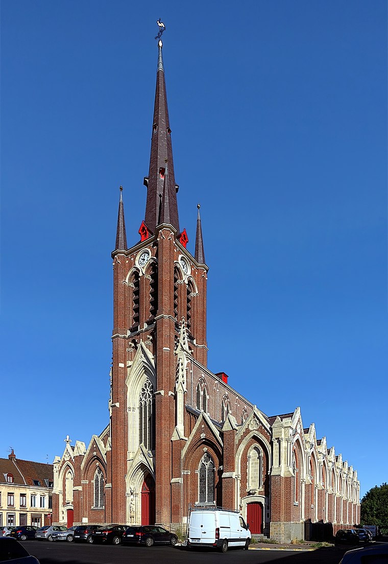
Photo: Velvet, CC BY-SA 3.0.
Église Notre-Dame de Fives is a church, which is situated 180 metres northwest of Alimentation de Fives.
Gare de Lille Europe
Railway station

Photo: JÄNNICK Jérémy, Public domain.
Lille–Europe station is a SNCF railway station in Lille, France, on the LGV Nord high-speed railway. The station is primarily used for international Eurostar and long-distance SNCF TGV services, although some high-speed regional trains also call at the station. Gare de Lille Europe is situated 1¼ km northwest of Alimentation de Fives.
Places in the Area
Nearby places include Fives and Porte de Tournai.
Fives
Suburb

Photo: PIERRE ANDRE LECLERCQ, CC BY-SA 4.0.
Fives is a former commune in the Nord department in northern France. It has been part of Lille since 1858. It gave its name to an engineering group founded in the nineteenth century, the Compagnie de Fives-Lille.

Porte de Valenciennes
Locality

Photo: VVVCFFrance, CC BY-SA 4.0.
Porte de Valenciennes is a locality.
Alimentation de Fives
- Type: Convenience store
- Wheelchair access: limited
- Categories: building, shop, retail building, and food
- Location: Lille, Arrondissement of Lille, North, Hauts-de-France, France, Europe
- View on OpenStreetMap
Latitude
50.63283° or 50° 37′ 58″ northLongitude
3.08929° or 3° 5′ 22″ eastLevels
3Open location code
9F25J3MQ+4POpenStreetMap ID
way 85101486OpenStreetMap feature
building=retailOpenStreetMap feature
shop=convenienceOpenStreetMap attribute
wheelchair=limited
This page is based on OpenStreetMap, Wikidata, and Wikimedia Commons.
We’d love your help improving our open data sources. Thank you for contributing.
Satellite Map
Discover Alimentation de Fives from above in high-definition satellite imagery.
Notable Places Nearby
Highlights include Bureau de Poste de Lille Fives and Place Pierre de Geyter.
Nearby Places
Explore places such as Société Générale and Assuriz.
Hauts-de-France: Must-Visit Destinations
Delve into Dunkirk, Calais, Amiens, and Arras.
Curious Convenience Stores to Discover
Uncover intriguing convenience stores from every corner of the globe.
About Mapcarta. Data © OpenStreetMap contributors and available under the Open Database License". Text is available under the CC BY-SA 4.0 license, except for photos, directions, and the map. Photo: Velvet, CC BY-SA 3.0.