Pegel Stephanskirchen/Sims
Pegel Stephanskirchen/Sims is a monitoring station in Stephanskirchen, Rosenheim, Bavaria. Pegel Stephanskirchen/Sims is situated nearby to the tourism office Tourist-Info Simssee, as well as near the church St. Stephanus.| Tap on a place to explore it |
Places of Interest Nearby
Highlights include St. Stephanus and Südufer des Simssees.
St. Stephanus
Church

Photo: Rufus46, CC BY-SA 3.0.
St. Stephanus is a church, which is situated 540 metres north of Pegel Stephanskirchen/Sims.
Südufer des Simssees
Nature reserve

Photo: Wikimedia, CC BY-SA 3.0.
Südufer des Simssees is a nature reserve.
Mariä Himmelfahrt
Church

Photo: 2015 Michael 2015, CC BY-SA 4.0.
Mariä Himmelfahrt is a church, which is situated 2 km southeast of Pegel Stephanskirchen/Sims.
Places in the Area
Nearby places include Riedering and Rosenheim.
Riedering
Village
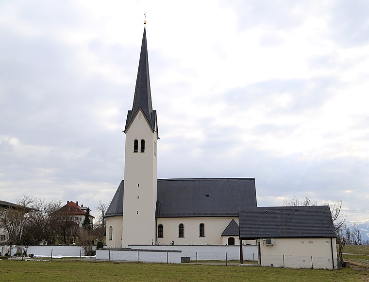
Photo: Rufus46, CC BY-SA 3.0.
Riedering is a municipality in the district of Rosenheim in Bavaria in Germany.
Rosenheim

Photo: Helmlechner, CC BY-SA 4.0.
Rosenheim is in the German state of Bavaria. It is south-east of Munich and has a population of 60,000.
Söllhuben
Village

Photo: Rufus46, CC BY-SA 3.0.
Söllhuben is a village, which is situated 5 km east of Pegel Stephanskirchen/Sims.
Pegel Stephanskirchen/Sims
- Type: Monitoring station
- Category: building
- Location: Stephanskirchen, Rosenheim, Upper Bavaria, Bavaria, Germany, Central Europe, Europe
- View on OpenStreetMap
Latitude
47.85013° or 47° 51′ 1″ northLongitude
12.18718° or 12° 11′ 14″ eastOpen location code
8FVJV52P+3VOpenStreetMap ID
way 852066192OpenStreetMap feature
building=yesOpenStreetMap feature
man_made=monitoring_station
This page is based on OpenStreetMap, Wikidata, and Wikimedia Commons.
We’d love your help improving our open data sources. Thank you for contributing.
Satellite Map
Discover Pegel Stephanskirchen/Sims from above in high-definition satellite imagery.
Notable Places Nearby
Highlights include Tourist-Info Simssee and Sims.
Nearby Places
Explore places such as Simsseer Braumanufaktur and KFZ Rimansberger.
Upper Bavaria: Must-Visit Destinations
Delve into Munich, Ingolstadt, Rosenheim, and Dachau.
Curious Monitoring Stations to Discover
Uncover intriguing monitoring stations from every corner of the globe.
About Mapcarta. Data © OpenStreetMap contributors and available under the Open Database License". Text is available under the CC BY-SA 4.0 license, except for photos, directions, and the map. Photo: Aconcagua, CC BY-SA 3.0.