ZAE Montbronn Est
ZAE Montbronn Est is in Montbronn, Arrondissement of Sarreguemines, Grand Est. ZAE Montbronn Est is situated nearby to the fire station Centre d’intervention de Montbronn-Enchenberg, as well as near the sports venue Salle multi-activités de Montbronn.| Tap on a place to explore it |
Places of Interest Nearby
Highlights include The Cristal Museum and Ludwigskirche (Saint-Louis-lès-Bitche).
The Cristal Museum
Museum
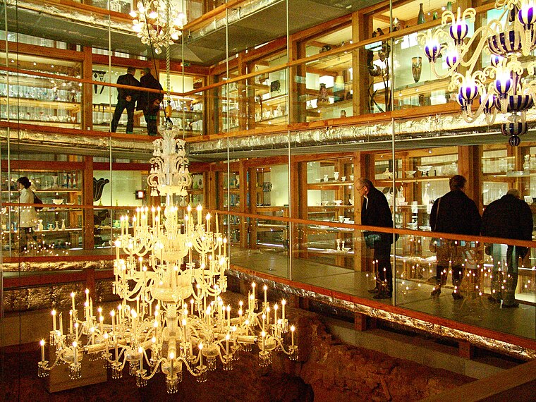
Photo: FannyCristal, CC BY-SA 3.0.
The Compagnie des Cristalleries de Saint Louis is a corporation, founded in 1586 in Münzthal in Lorraine. It is the oldest glass manufacturer in France with roots dating back to 1586 and the first crystal glass manufacturer in continental Europe. The Cristal Museum is situated 2 km southeast of ZAE Montbronn Est.
Ludwigskirche (Saint-Louis-lès-Bitche)
Church

Photo: Perreal, CC BY-SA 3.0.
Ludwigskirche (Saint-Louis-lès-Bitche) is a church, which is situated 2 km southeast of ZAE Montbronn Est.
Église Saint-Pierre d’Enchenberg
Church

Photo: Wikimedia, CC BY-SA 2.5.
Église Saint-Pierre d’Enchenberg is a church, which is situated 2 km north of ZAE Montbronn Est.
Places in the Area
Nearby places include Eidenheim glassworks and Loechersbach mill.
Eidenheim glassworks
Locality

Photo: ThePierrasse, CC BY-SA 4.0.
Eidenheim glassworks is a locality.
Loechersbach mill
Locality

Photo: ThePierrasse, CC BY-SA 4.0.
Loechersbach mill is a locality, which is situated 3½ km northeast of ZAE Montbronn Est.
Sarreinsberg
Neighborhood

Photo: Wikimedia, Public domain.
Sarreinsberg is a neighborhood, which is situated 4½ km southeast of ZAE Montbronn Est.
ZAE Montbronn Est
- Type: Industry
- Location: Montbronn, Arrondissement of Sarreguemines, Moselle, Grand Est, France, Europe
- View on OpenStreetMap
Latitude
48.99801° or 48° 59′ 53″ northLongitude
7.32973° or 7° 19′ 47″ eastOpen location code
8FW9X8XH+6VOpenStreetMap ID
way 854405731OpenStreetMap feature
landuse=industrial
This page is based on OpenStreetMap, Wikidata, and Wikimedia Commons.
We’d love your help improving our open data sources. Thank you for contributing.
Satellite Map
Discover ZAE Montbronn Est from above in high-definition satellite imagery.
In Other Languages
“ZAE Montbronn Est” goes by many names.
- German: “Gewerbegebiet Mombronn Ost”
Notable Places Nearby
Highlights include Centre d’intervention de Montbronn-Enchenberg and Salle multi-activités de Montbronn.
Nearby Places
Explore places such as Zone d’activité économique Montbronn Est and Crédit Mutuel.
Grand Est: Must-Visit Destinations
Delve into Strasbourg, Reims, Metz, and Nancy.
Curious Places to Discover
Uncover intriguing places from every corner of the globe.
About Mapcarta. Data © OpenStreetMap contributors and available under the Open Database License". Text is available under the CC BY-SA 4.0 license, except for photos, directions, and the map. Photo: Cédric Bonhomme, CC BY-SA 3.0.