Sparkassenhäuschen
Sparkassenhäuschen is a building in Wittenberg, Saxony-Anhalt. Sparkassenhäuschen is situated nearby to the park Grünanlage, as well as near the church St. Gertrud (Pratau).| Tap on a place to explore it |
Places of Interest Nearby
Highlights include St. Gertrud (Pratau) and Pratau railway station.
St. Gertrud (Pratau)
Church
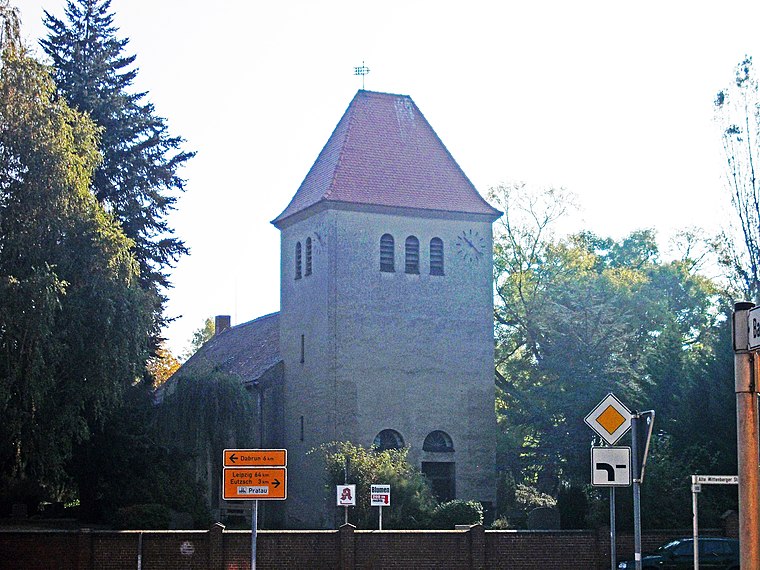
Photo: Jwaller, CC BY-SA 3.0.
St. Gertrud (Pratau) is a church, which is situated 200 metres south of Sparkassenhäuschen.
Pratau railway station
Railway station

Photo: Jwaller, CC BY-SA 3.0.
Pratau railway station is situated 680 metres west of Sparkassenhäuschen.
Elbebrücke Lutherstadt Wittenberg (road)
Bridge

Photo: Falk2, CC BY-SA 4.0.
Elbebrücke Lutherstadt Wittenberg (road) is a bridge, which is situated 1½ km north of Sparkassenhäuschen.
Places in the Area
Nearby places include Mühlanger and Abtsdorf.
Mühlanger
Village

Photo: Radler59, CC BY-SA 3.0.
Mühlanger is a village and a former municipality in Wittenberg district in Saxony-Anhalt, Germany. Since 1 January 2014, it is part of the town Zahna-Elster. Mühlanger is situated 7 km east of Sparkassenhäuschen.
Abtsdorf
Village
Abtsdorf is a village and a former municipality in the Wittenberg district of Saxony-Anhalt in Germany. Since 1 January 2009, it has been part of the town of Wittenberg. Abtsdorf is situated 7 km northeast of Sparkassenhäuschen.
Zörnigall
Village
Zörnigall is a village and a former municipality in Wittenberg district in Saxony-Anhalt, Germany. Since 1 January 2011, it is part of the town Zahna-Elster. It belonged to the administrative municipality of Elbaue-Fläming. Zörnigall is situated 7 km northeast of Sparkassenhäuschen.
Sparkassenhäuschen
- Type: Building
- Location: Wittenberg, Wittenberg, Saxony-Anhalt, Germany, Central Europe, Europe
- View on OpenStreetMap
Latitude
51.84451° or 51° 50′ 40″ northLongitude
12.64454° or 12° 38′ 40″ eastOpen location code
9F3JRJVV+RROpenStreetMap ID
way 865999620OpenStreetMap feature
building=yes
This page is based on OpenStreetMap, Wikidata, and Wikimedia Commons.
We’d love your help improving our open data sources. Thank you for contributing.
Satellite Map
Discover Sparkassenhäuschen from above in high-definition satellite imagery.
Notable Places Nearby
Highlights include Grünanlage and Flutbrücke I.
Nearby Places
Explore places such as Pratau, Freischütz and Nah und Gut Habedank.
Saxony-Anhalt: Must-Visit Destinations
Delve into Magdeburg, Halle, Quedlinburg, and Eisleben.
Curious Buildings to Discover
Uncover intriguing buildings from every corner of the globe.
About Mapcarta. Data © OpenStreetMap contributors and available under the Open Database License". Text is available under the CC BY-SA 4.0 license, except for photos, directions, and the map. Photo: Theotherpaul, CC BY-SA 3.0.