Jessie Andrews Park
Jessie Andrews Park is a park in Travis, Texas which is located on Philomena Street. Jessie Andrews Park is situated nearby to the theater building Austin Film Society, as well as near the food court Main Streat by H-E-B Food Hall and Bar.| Tap on a place to explore it |
- Opening hours: 7:00 AM—10:00 PM
- Type: Park
- Address: 2610 Philomena Street, Austin, TX 78723
Places of Interest Nearby
Highlights include Thinkery and Austin Peace Academy.
Thinkery
Museum
 Thinkery is a children's museum in Austin, Texas. Thinkery is situated 2,800 feet west of Jessie Andrews Park.
Austin Peace Academy
School
 Austin Peace Academy is an Islamic school in Austin, Texas, serving pre-kindergarten through grade 12. As of 2016, its students originate from 19 nationalities. Austin Peace Academy is situated 2,600 feet east of Jessie Andrews Park.
Lyndon Baines Johnson Museum
Museum
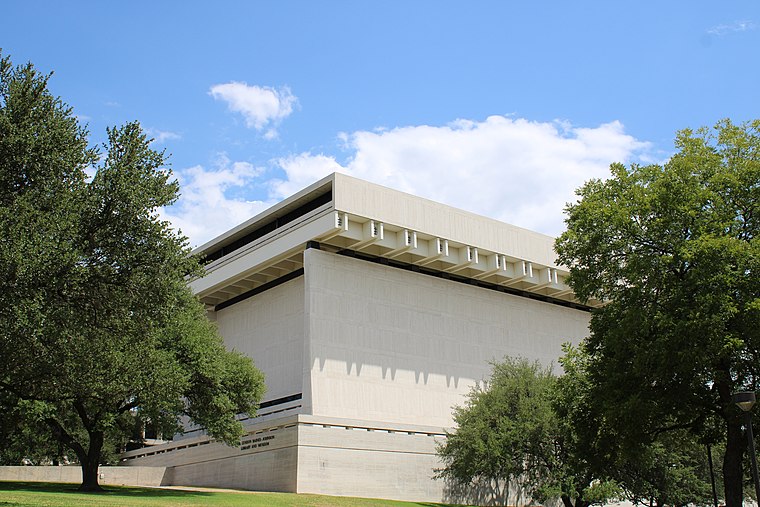
Photo: Enmanuel, CC BY-SA 4.0.
The Lyndon Baines Johnson Library and Museum, also known as the LBJ Presidential Library, is the presidential library and museum of Lyndon Baines Johnson, the 36th president of the United States. Lyndon Baines Johnson Museum is situated 2 miles southwest of Jessie Andrews Park.
Places in the Area
Nearby places include Mueller Community and East Austin.
Mueller Community
Neighborhood
 Mueller is a 711-acre Planned Unit Development in the east-central portion of the city of Austin, Texas, United States. The project is in the process of long-term development on the former site of the Robert Mueller Municipal Airport, which was closed in 1999…
East Austin

Photo: LoneStarMike, CC BY 3.0.
East Austin is a district of Austin, to the north of Lady Bird Lake and to the east of IH-35. This includes the area set aside as the "Negro district" in the infamous 1928 official city segregation plan, and "Mexicans" were informally encouraged to concentrate here.
Windsor Park
Neighborhood
The Windsor Park neighborhood is located in Austin, Texas, and bounded on the south by 51st St. to Tilley St, southwest to Philomena St, southeast along the Central Texas Emergency Command Center and Troublemaker Studios property line to Zach Scott St, east to Manor Rd, northeast to Northeast Dr, northwest/north to US Highway 290, east to IH35, then south to E 51st St.
Jessie Andrews Park
- Category: recreation area
- Location: Travis, Texas, United States, North America
- View on OpenStreetMap
Latitude
30.29918° or 30° 17′ 57″ northLongitude
-97.69612° or 97° 41′ 46″ westOpen location code
862478X3+MHOpenStreetMap ID
way 870605637OpenStreetMap feature
leisure=park
This page is based on OpenStreetMap, Wikidata, and Wikimedia Commons.
We’d love your help improving our open data sources. Thank you for contributing.
Satellite Map
Discover Jessie Andrews Park from above in high-definition satellite imagery.
Notable Places Nearby
Highlights include Austin Film Society and Main Streat by H-E-B Food Hall and Bar.
Nearby Places
Explore places such as Ocho and Bungalow O.
Texas: Must-Visit Destinations
Delve into Houston, Austin, Dallas, and San Antonio.
Curious Parks to Discover
Uncover intriguing parks from every corner of the globe.
About Mapcarta. Data © OpenStreetMap contributors and available under the Open Database License". Text is available under the CC BY-SA 4.0 license, except for photos, directions, and the map. Photo: Wikimedia, CC0.