Kimberley-Clark
Kimberley-Clark is in Hendersonville, North Carolina Mountains, North Carolina. Kimberley-Clark is situated nearby to the village Balfour, as well as near Berkeley Mills Park.| Tap on a place to explore it |
Places of Interest Nearby
Highlights include Mineral and Lapidary Museum.
Mineral and Lapidary Museum
Museum
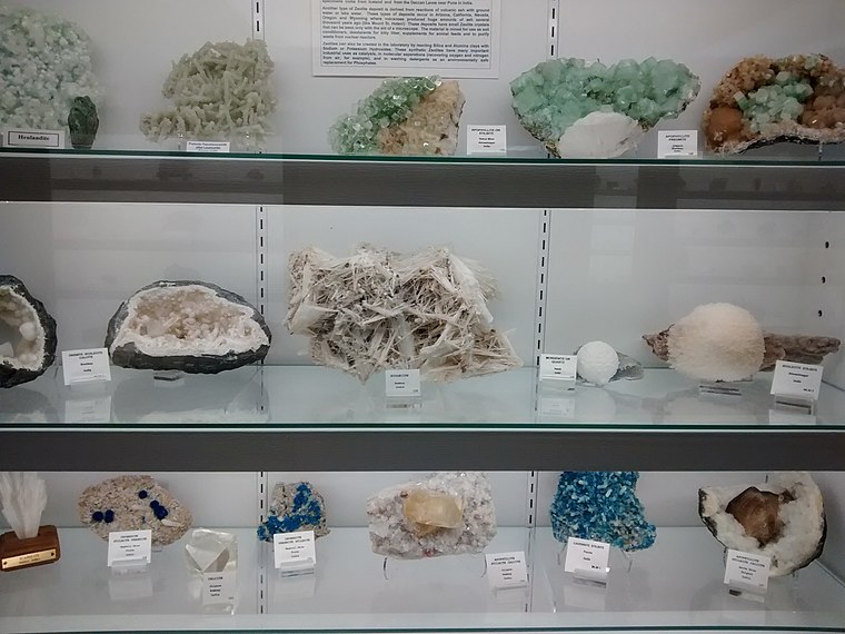
Photo: Mx. Granger, CC0.
The Mineral and Lapidary Museum of Henderson County is a non-profit, volunteer-run museum in Hendersonville, North Carolina, United States, founded in 1997 at 400 North Main Street in the middle of the city's Historic District. Mineral and Lapidary Museum is situated 2 miles south of Kimberley-Clark.
Places in the Area
Nearby places include Balfour and Mountain Home.
Balfour
Village
Balfour is an unincorporated community and census-designated place in Henderson County, North Carolina, United States. The population was 1,187 at the 2010 census. It is part of the Asheville Metropolitan Statistical Area.
Mountain Home
Village
Mountain Home is an unincorporated community and census-designated place in Henderson County, North Carolina, United States. The population was 3,622 at the 2010 census, up from 2,169 in 2000. It is part of the Asheville Metropolitan Statistical Area. Mountain Home is situated 2 miles northwest of Kimberley-Clark.
Naples
Hamlet
Naples is an unincorporated community in Henderson County, North Carolina, United States, part of the Asheville metropolitan area. It is located near U.S. Route 25 Business and Interstate 26 exit 44. Naples is situated 3½ miles northwest of Kimberley-Clark.
Kimberley-Clark
Latitude
35.34567° or 35° 20′ 44″ northLongitude
-82.46888° or 82° 28′ 8″ westOpen location code
867V8GWJ+7COpenStreetMap ID
way 890496784OpenStreetMap feature
landuse=industrial
This page is based on OpenStreetMap, Wikidata, and Wikimedia Commons.
We’d love your help improving our open data sources. Thank you for contributing.
Satellite Map
Discover Kimberley-Clark from above in high-definition satellite imagery.
Places with the Same Name
Discover other places named “Kimberley-Clark”.
Notable Places Nearby
Highlights include Berkeley Mills Park and Berkeley Mills Ballpark.
Nearby Places
Explore places such as Henderson Substation and Relevé Performing Arts Center.
North Carolina Mountains: Must-Visit Destinations
Delve into Asheville, Waynesville, Brevard, and Boone.
Curious Places to Discover
Uncover intriguing places from every corner of the globe.
About Mapcarta. Data © OpenStreetMap contributors and available under the Open Database License". Text is available under the CC BY-SA 4.0 license, except for photos, directions, and the map. Photo: Mx. Granger, CC0.