Campingplatz Hirtenteich
Campingplatz Hirtenteich is a campsite in Essingen, Ostalbkreis, Baden-Württemberg which is located on Hasenweide. Campingplatz Hirtenteich is situated nearby to the forest Hinterer Hirtenteich, as well as near the scenic viewpoint Panoramablick auf Essingen.| Tap on a place to explore it |
- Type: Campsite
- Address: Hasenweide 2, Lauterburg, Essingen, 73457
- Wheelchair access: yes
Places of Interest Nearby
Highlights include Ruine Lauterburg and Rosenstein.
Ruine Lauterburg
Castle

Photo: Geak, Copyrighted free use.
Ruine Lauterburg is a castle, which is situated 390 metres southwest of Campingplatz Hirtenteich.


Places in the Area
Nearby places include Lauterburg and Lautern.
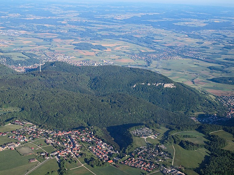

Heubach
Town

Photo: Kreuzschnabel, CC BY-SA 3.0.
Heubach is a town in the Ostalbkreis district, in Baden-Württemberg, Germany. It is located 10 km east of Schwäbisch Gmünd, and 13 km southwest of Aalen. Heubach is situated 3½ km west of Campingplatz Hirtenteich.
Campingplatz Hirtenteich
- Categories: tourism and camping
- Location: Essingen, Ostalbkreis, Stuttgart, Baden-Württemberg, Germany, Central Europe, Europe
- View on OpenStreetMap
Latitude
48.78658° or 48° 47′ 12″ northLongitude
9.98055° or 9° 58′ 50″ eastOpen location code
8FWFQXPJ+J6OpenStreetMap ID
way 89502885OpenStreetMap feature
tourism=camp_siteOpenStreetMap attribute
wheelchair=yes
This page is based on OpenStreetMap, Wikidata, and Wikimedia Commons.
We’d love your help improving our open data sources. Thank you for contributing.
Satellite Map
Discover Campingplatz Hirtenteich from above in high-definition satellite imagery.
Notable Places Nearby
Highlights include Hinterer Hirtenteich and Panoramablick auf Essingen.
Nearby Places
Explore places such as Wirtshaus am Pfaffensturz and Ulli’s Imbiß.
Baden-Württemberg: Must-Visit Destinations
Delve into Stuttgart, Heidelberg, Karlsruhe, and Mannheim.
Curious Campsites to Discover
Uncover intriguing campsites from every corner of the globe.
About Mapcarta. Data © OpenStreetMap contributors and available under the Open Database License". Text is available under the CC BY-SA 4.0 license, except for photos, directions, and the map. Photo: Traveler100, CC BY-SA 3.0.