Saint-Benoît d’Hébertot-Mairie
Saint-Benoît d’Hébertot-Mairie is a shelter in Saint-Benoît-d’Hébertot, Arrondissement of Lisieux, Normandy. Saint-Benoît d’Hébertot-Mairie is situated nearby to the church Église Saint-Benoît de Saint-Benoît-d’Hébertot, as well as near the historic house Ancien prieuré.| Tap on a place to explore it |
Places of Interest Nearby
Highlights include Église Saint-Benoît de Saint-Benoît-d’Hébertot and Château de Saint-André-d’Hébertot.
Église Saint-Benoît de Saint-Benoît-d’Hébertot
Church

Photo: Pymouss, CC BY-SA 3.0.
Église Saint-Benoît de Saint-Benoît-d’Hébertot is a church, which is situated 110 metres south of Saint-Benoît d’Hébertot-Mairie.
Château de Saint-André-d’Hébertot
Castle

Photo: Sdo216, CC BY-SA 4.0.
Château de Saint-André-d’Hébertot is a castle, which is situated 1 km southeast of Saint-Benoît d’Hébertot-Mairie.
Église de Saint-André-d’Hébertot
Church

Photo: Coyau, CC BY-SA 3.0.
Église de Saint-André-d’Hébertot is a church, which is situated 1 km southeast of Saint-Benoît d’Hébertot-Mairie.
Places in the Area
Nearby places include Vieux-Bourg and Le Theil-en-Auge.
Vieux-Bourg
Village

Photo: Pradigue, CC BY-SA 4.0.
Vieux-Bourg is a commune in the Calvados department in the Normandy region in northwestern France.
Le Theil-en-Auge
Village

Photo: Pymouss, CC BY-SA 3.0.
Le Theil-en-Auge is a commune in the Calvados department in the Normandy region in northwestern France. Le Theil-en-Auge is situated 3½ km northwest of Saint-Benoît d’Hébertot-Mairie.
Saint-Julien-sur-Calonne
Village
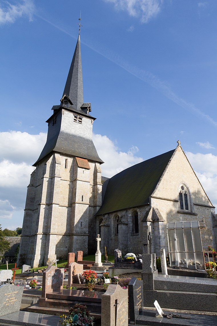
Photo: EdouardHue, CC BY-SA 3.0.
Saint-Julien-sur-Calonne is a commune in the Calvados department in the Normandy region in northwestern France. Saint-Julien-sur-Calonne is situated 4½ km southwest of Saint-Benoît d’Hébertot-Mairie.
Saint-Benoît d’Hébertot-Mairie
- Type: Shelter
- Category: building
- Location: Saint-Benoît-d’Hébertot, Arrondissement of Lisieux, Calvados, Normandy, France, Europe
- View on OpenStreetMap
Latitude
49.31714° or 49° 19′ 2″ northLongitude
0.26967° or 0° 16′ 11″ eastOpen location code
8FX28789+VVOpenStreetMap ID
way 895663285OpenStreetMap feature
amenity=shelterOpenStreetMap feature
building=yes
This page is based on OpenStreetMap, Wikidata, and Wikimedia Commons.
We’d love your help improving our open data sources. Thank you for contributing.
Satellite Map
Discover Saint-Benoît d’Hébertot-Mairie from above in high-definition satellite imagery.
Notable Places Nearby
Highlights include Ancien prieuré and Cimetière de Saint-André-d’Hébertot.
Nearby Places
Explore places such as Trianon and Les Barquets.
Normandy: Must-Visit Destinations
Delve into Orne, Rouen, Seine-Maritime, and Le Havre.
Curious Shelters to Discover
Uncover intriguing shelters from every corner of the globe.
About Mapcarta. Data © OpenStreetMap contributors and available under the Open Database License". Text is available under the CC BY-SA 4.0 license, except for photos, directions, and the map. Photo: Inkey, CC BY-SA 3.0.