Ruinas del Taller del Ferrocarril
Ruinas del Taller del Ferrocarril is a building in Simón Bolívar Municipality, Anzoátegui. Ruinas del Taller del Ferrocarril is situated nearby to the pitch Cancha, as well as near the university Ugma Clínica de Adultos.| Tap on a place to explore it |
Places of Interest Nearby
Highlights include St. Christopher’s Cathedral and General José Antonio Anzoátegui International Airport.
St. Christopher’s Cathedral
Church

Photo: Wikimedia, Public domain.
St. Christopher's Cathedral or Barcelona Cathedral is the cathedral of the Roman Catholic Diocese of Barcelona in Venezuela. It is located in the historic center of the city of Barcelona, the capital of Anzoátegui State northwest of Venezuela. St. Christopher’s Cathedral is situated 1 km southwest of Ruinas del Taller del Ferrocarril.
General José Antonio Anzoátegui International Airport
Aerodrome

Photo: Manumartinez, CC BY-SA 3.0.
General José Antonio Anzoátegui International Airport It is the international airport of the city of Barcelona, Venezuela, capital of the Anzoátegui State. General José Antonio Anzoátegui International Airport is situated 4 km southwest of Ruinas del Taller del Ferrocarril.
Places in the Area
Nearby places include Puerto La Cruz.
Puerto La Cruz
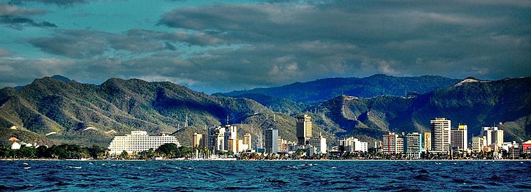
Photo: Hiddendaemian, CC BY 2.0.
Puerto La Cruz is a city in Venezuela's Northeast, in the state of Anzoátegui. In some ways, it's kind of like the beachside resort area for Barcelona nearby, although it is tainted a bit by the fact that it's also the home of the Puerto La Cruz refinery, one of the largest in the country, along with a fossil fuel processing plant.
Ruinas del Taller del Ferrocarril
- Type: Building
- Location: Simón Bolívar Municipality, Anzoátegui, Venezuela, South America
- View on OpenStreetMap
Latitude
10.13925° or 10° 8′ 21″ northLongitude
-64.67937° or 64° 40′ 46″ westOpen location code
772Q48QC+M7OpenStreetMap ID
way 897359967OpenStreetMap feature
building=yes
This page is based on OpenStreetMap, Wikidata, and Wikimedia Commons.
We’d love your help improving our open data sources. Thank you for contributing.
Satellite Map
Discover Ruinas del Taller del Ferrocarril from above in high-definition satellite imagery.
Notable Places Nearby
Highlights include Cancha and Ugma Clínica de Adultos.
Nearby Places
Explore places such as Ruinas taller del ferrocarril and esperanza.
Venezuela: Must-Visit Destinations
Delve into Caracas, Mérida, Maracaibo, and Táchira.
Curious Buildings to Discover
Uncover intriguing buildings from every corner of the globe.
About Mapcarta. Data © OpenStreetMap contributors and available under the Open Database License". Text is available under the CC BY-SA 4.0 license, except for photos, directions, and the map. Photo: Rjcastillo, CC BY-SA 3.0.