Kiosque du parc des Bourins
Kiosque du parc des Bourins is a bandstand in Vichy, Allier, Auvergne-Rhône-Alpes. Kiosque du parc des Bourins is situated nearby to the sports venue Parc du Soleil, as well as near the place of worship Temple antoiniste.| Tap on a place to explore it |
Photo: Deslignes, CC BY-SA 3.0.
Places of Interest Nearby
Highlights include Temple antoiniste and Pôle universitaire et technologique Lardy.
Temple antoiniste
Place of worship

Photo: Europe22, CC BY-SA 3.0.
Temple antoiniste is a place of worship, which is situated 260 metres north of Kiosque du parc des Bourins.
Pôle universitaire et technologique Lardy
University
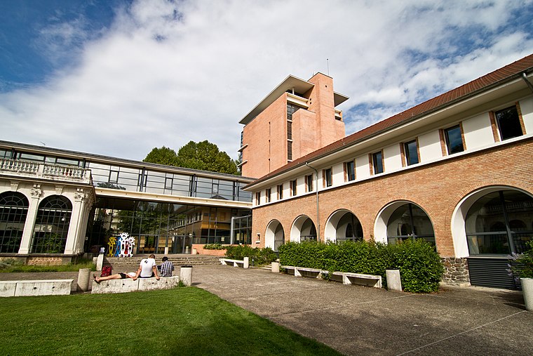
Photo: Wikimedia, CC BY-SA 2.0.
Pôle universitaire et technologique Lardy is an university, which is situated 420 metres northwest of Kiosque du parc des Bourins.
Couvent des Célestins (Vichy)
Historic building

Photo: Tabl-trai, CC BY-SA 4.0.
Couvent des Célestins (Vichy) is a historic building, which is situated 520 metres northwest of Kiosque du parc des Bourins.
Places in the Area
Nearby places include Bellerive-sur-Allier and Cusset.
Bellerive-sur-Allier
Village

Photo: Calips, CC BY-SA 3.0.
Bellerive-sur-Allier is a commune in the Allier department in central France. Known as Vesse or Vaisse, it was renamed Bellerive-sur-Allier in 1903.
Cusset
Town

Photo: Jojovichy, CC BY-SA 3.0.
Cusset is a commune in the department of Allier, in the central French region of Auvergne. Situated in the foothills of the Bourbonnaise Mountains, the city is a suburb of Vichy and ranks fourth in population for the department. Cusset is situated 3 km northeast of Kiosque du parc des Bourins.
Serbannes
Village

Photo: Tabl-trai, CC BY-SA 3.0.
Serbannes is a commune in the Allier department in Auvergne-Rhône-Alpes in central France. Serbannes is situated 6 km west of Kiosque du parc des Bourins.
Kiosque du parc des Bourins
- Type: Bandstand
- Description: bandstand in Vichy
- Categories: building, recreation area, and historic site
- Location: Vichy, Arrondissement of Vichy, Allier, Auvergne, Auvergne-Rhône-Alpes, France, Europe
- View on OpenStreetMap
Latitude
46.11769° or 46° 7′ 4″ northLongitude
3.42982° or 3° 25′ 47″ eastOpen location code
8FR54C9H+3WOpenStreetMap ID
way 90604998OpenStreetMap feature
building=yesOpenStreetMap feature
historic=yesOpenStreetMap feature
leisure=bandstandWikidata ID
Q27603095
This page is based on OpenStreetMap, Wikidata, and Wikimedia Commons.
We’d love your help improving our open data sources. Thank you for contributing.
Satellite Map
Discover Kiosque du parc des Bourins from above in high-definition satellite imagery.
In Other Languages
From French to Spanish—“Kiosque du parc des Bourins” goes by many names.
- French: “kiosque du parc des Bourins”
- French: “Kiosque du parc des Bourins”
- Spanish: “Kiosco de música en Vichy”
Notable Places Nearby
Highlights include Parc du Soleil and EHPAD Le Vert Galant.
Nearby Places
Explore places such as Val d’Or and Les Bourins.
Auvergne: Must-Visit Destinations
Delve into Clermont-Ferrand, Puy-de-Dôme, Aurillac, and Le Puy-en-Velay.
Curious Bandstands to Discover
Uncover intriguing bandstands from every corner of the globe.
About Mapcarta. Data © OpenStreetMap contributors and available under the Open Database License". Text is available under the CC BY-SA 4.0 license, except for photos, directions, and the map. Photo: Deslignes, CC BY-SA 3.0.