David C. Ellis Community Center
David C. Ellis Community Center is a park in Travis, Texas which is located on Doe Run. David C. Ellis Community Center is situated nearby to Gatling Gun Park, as well as near the residential area Shady Hollow.| Tap on a place to explore it |
Places of Interest Nearby
Highlights include Shady Hollow and Southland Oaks Neighborhood Park.
Shady Hollow
Residential area
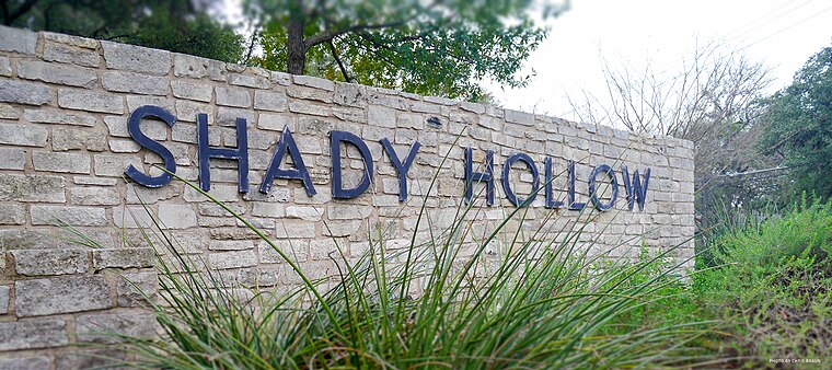
Photo: Chris.w.braun, CC BY-SA 4.0.
Shady Hollow is a census-designated place in southwestern Travis County, Texas, United States, and is partially in the City of Austin. It is located ten miles southwest of Downtown Austin, near the Travis/Hays county line. Shady Hollow is situated 2,800 feet southwest of David C. Ellis Community Center.
Southland Oaks Neighborhood Park
Park

Photo: StuckInLagToad, CC BY-SA 4.0.
Southland Oaks Neighborhood Park is situated 1 mile southwest of David C. Ellis Community Center.
Lost Oasis Cave Preserve
Nature reserve

Photo: VPaleontologist, CC BY-SA 4.0.
Lost Oasis Cave Preserve is a nature reserve.
Places in the Area
Nearby places include Manchaca and San Leanna.
Manchaca
Village
Photo: WhisperToMe, Public domain.
Manchaca is a census-designated place in Travis County, Texas, United States. It is located 10 miles southwest of downtown Austin. This was a new CDP for the 2020 census with a population of 2,266. Manchaca is situated 2½ miles southeast of David C. Ellis Community Center.
San Leanna
Village

Photo: WhisperToMe, Public domain.
San Leanna is a village in Travis County, Texas, United States. The population was 522 at the 2020 census. San Leanna is situated 2½ miles southeast of David C. Ellis Community Center.
Hays
Village
Hays is a city in Hays County, Texas, United States. The population was 227 at the 2020 census. Hays is situated 3½ miles south of David C. Ellis Community Center.
David C. Ellis Community Center
- Type: Park
- Address: 3303 Doe Run, Austin, TX 78748
- Category: recreation area
- Location: Travis, Texas, United States, North America
- View on OpenStreetMap
Latitude
30.16922° or 30° 10′ 9″ northLongitude
-97.85226° or 97° 51′ 8″ westOperator
Shady Hollow Home Owners AssociationOpen location code
8624549X+M3OpenStreetMap ID
way 906957805OpenStreetMap feature
leisure=park
This page is based on OpenStreetMap, Wikidata, and Wikimedia Commons.
We’d love your help improving our open data sources. Thank you for contributing.
Satellite Map
Discover David C. Ellis Community Center from above in high-definition satellite imagery.
Notable Places Nearby
Highlights include Gatling Gun Park and Bauerle Ranch at Slaughter Creek Greenbelt.
Nearby Places
Explore places such as Shady Hollow Community Center and George P. Glaser LCSW.
Texas: Must-Visit Destinations
Delve into Houston, Austin, Dallas, and San Antonio.
Curious Parks to Discover
Uncover intriguing parks from every corner of the globe.
About Mapcarta. Data © OpenStreetMap contributors and available under the Open Database License". Text is available under the CC BY-SA 4.0 license, except for photos, directions, and the map. Photo: Wikimedia, CC0.