Socsa Elevange
Socsa Elevange is an office building in Coulounieix-Chamiers, Arrondissement of Périgueux, Nouvelle-Aquitaine which is located on Boulevard des Saveurs. Socsa Elevange is situated nearby to the government office Atd24 - salle de formation, as well as near the government building Pole Interconsulaire.| Tap on a place to explore it |
Places of Interest Nearby
Highlights include Église Saint-Michel de Coulounieix and War memorial of Coulounieix-Chamiers.
Église Saint-Michel de Coulounieix
Church

Photo: Père Igor, CC BY-SA 4.0.
Église Saint-Michel de Coulounieix is a church, which is situated 1¼ km northwest of Socsa Elevange.
War memorial of Coulounieix-Chamiers
Memorial

Photo: Père Igor, CC BY-SA 4.0.
War memorial of Coulounieix-Chamiers is situated 1½ km northwest of Socsa Elevange.
Château de la Rolphie
Castle
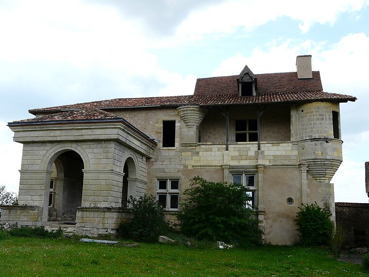
Photo: Père Igor, CC BY-SA 3.0.
Château de la Rolphie is a castle, which is situated 3 km west of Socsa Elevange.
Places in the Area
Nearby places include Atur and Périgueux.
Atur
Village

Photo: Père Igor, CC BY-SA 3.0.
Atur is a former commune in the Dordogne department in southwestern France. On 1 January 2016, it was merged into the new commune Boulazac Isle Manoire. Atur is situated 4 km east of Socsa Elevange.
Périgueux

Photo: Père Igor, CC BY-SA 3.0.
Périgueux is a commune in the Dordogne department, in the administrative region of Nouvelle-Aquitaine, southwestern France. Périgueux is the prefecture of Dordogne, and the capital city of Périgord. It is also the seat of a Roman Catholic diocese.
Coulounieix-Chamiers
Village

Photo: Père Igor, CC BY-SA 3.0.
Coulounieix-Chamiers is a commune in the Dordogne department in Nouvelle-Aquitaine in southwestern France. It is a suburb of Périgueux. Coulounieix-Chamiers is situated 4½ km north of Socsa Elevange.
Socsa Elevange
- Type: Office building
- Address: Boulevard des Saveurs, Coulounieix-Chamiers, 24660
- Categories: building and office
- Location: Coulounieix-Chamiers, Arrondissement of Périgueux, Dordogne, Nouvelle-Aquitaine, France, Europe
- View on OpenStreetMap
Latitude
45.14679° or 45° 8′ 48″ northLongitude
0.69696° or 0° 41′ 49″ eastLevels
1Open location code
8FQ24MWW+PQOpenStreetMap ID
way 911212534OpenStreetMap feature
building=office
This page is based on OpenStreetMap, Wikidata, and Wikimedia Commons.
We’d love your help improving our open data sources. Thank you for contributing.
Satellite Map
Discover Socsa Elevange from above in high-definition satellite imagery.
Notable Places Nearby
Highlights include Atd24 - salle de formation and Pole Interconsulaire.
Nearby Places
Explore places such as ARIANE BUREAUTIQUE and BCA Expertise.
Dordogne: Must-Visit Destinations
Delve into Périgueux, Sarlat-la-Canéda, Bergerac, and Rocamadour.
Curious Office Buildings to Discover
Uncover intriguing office buildings from every corner of the globe.
About Mapcarta. Data © OpenStreetMap contributors and available under the Open Database License". Text is available under the CC BY-SA 4.0 license, except for photos, directions, and the map. Photo: Sémhur, CC BY-SA 3.0.