Standis Polska
Standis Polska is a factory in Gmina Oława, Oława County, Lower Silesian Voivodeship. Standis Polska is situated nearby to the cemetery Cmentarz Stary, as well as near Cmentarz Żołnierzy Radzieckich.| Tap on a place to explore it |
Places of Interest Nearby
Highlights include Saint Joseph Husband of Mary church in Oława and Saint Roch church in Oława.
Saint Joseph Husband of Mary church in Oława
Church

Photo: Fangorn90, CC BY-SA 3.0.
Saint Joseph Husband of Mary church in Oława is situated 380 metres west of Standis Polska.
Saint Roch church in Oława
Church
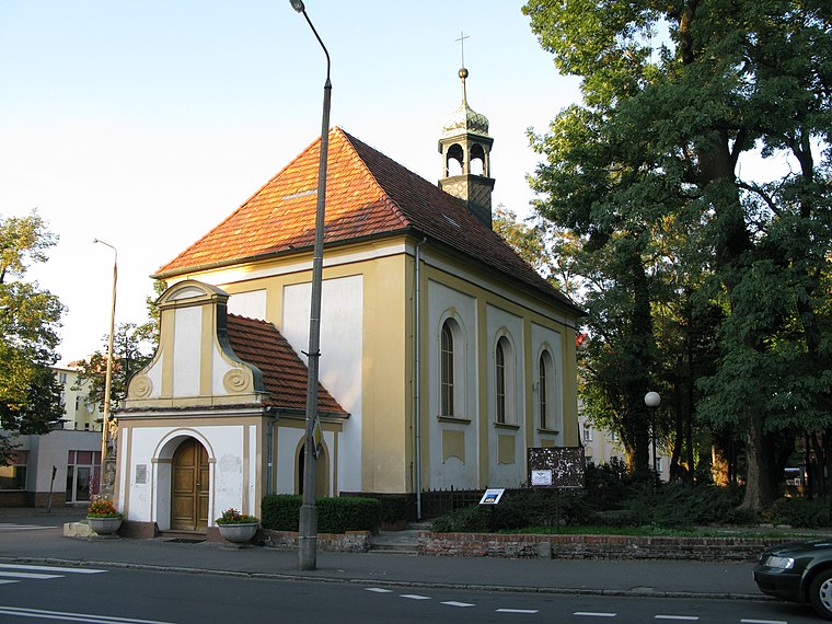
Photo: Woytas71, CC BY-SA 3.0 pl.
Saint Roch church in Oława is situated 710 metres west of Standis Polska.
Our Lady church in Oława
Church

Photo: Julo, Public domain.
Our Lady church in Oława is situated 1 km west of Standis Polska.
Places in the Area
Nearby places include Oława and Ścinawa Polska.
Oława
Town
Photo: SMilejski, CC BY-SA 3.0 pl.
Oława is a historic town in south-western Poland with 33,029 inhabitants. It is situated in Lower Silesian Voivodeship, within the Wrocław metropolitan area. It is the seat of Oława County and of the smaller administrative district of Gmina Oława.
Ścinawa Polska
Village
Ścinawa Polska is a village in the administrative district of Gmina Oława, within Oława County, Lower Silesian Voivodeship, in south-western Poland.
Stary Górnik
Village

Photo: Robert Niedźwiedzki, CC BY-SA 4.0.
Stary Górnik is a village in the administrative district of Gmina Oława, within Oława County, Lower Silesian Voivodeship, in south-western Poland. Stary Górnik is situated 3 km northeast of Standis Polska.
Standis Polska
- Type: Factory
- Category: industry
- Location: Gmina Oława, Oława County, Lower Silesian Voivodeship, Poland, Central Europe, Europe
- View on OpenStreetMap
Latitude
50.94204° or 50° 56′ 31″ northLongitude
17.3071° or 17° 18′ 26″ eastOpen location code
9F2VW8R4+RROpenStreetMap ID
way 917547856OpenStreetMap feature
man_made=works
This page is based on OpenStreetMap, Wikidata, and Wikimedia Commons.
We’d love your help improving our open data sources. Thank you for contributing.
Satellite Map
Discover Standis Polska from above in high-definition satellite imagery.
Notable Places Nearby
Highlights include Cmentarz Stary and Cmentarz Żołnierzy Radzieckich.
Nearby Places
Explore places such as Zwierzyniecka Cmentarz and FamiDental.
Lower Silesian Voivodeship: Must-Visit Destinations
Delve into Wrocław, Legnica, Wałbrzych, and Głogów.
Curious Factories to Discover
Uncover intriguing factories from every corner of the globe.
About Mapcarta. Data © OpenStreetMap contributors and available under the Open Database License". Text is available under the CC BY-SA 4.0 license, except for photos, directions, and the map. Photo: Sicherlich, CC BY 3.0.