Steinlache
Steinlache is a river in Schkopau, Saalekreis, Saxony-Anhalt. Steinlache is situated nearby to the village Korbetha, as well as near the hamlet Planena.| Tap on a place to explore it |
Places of Interest
Highlights include Schloss Schkopau and Surp Harutyun church.


Places in the Area
Nearby places include Merseburg and Schkopau.
Merseburg

Photo: Hoger, CC BY-SA 3.0 de.
Merseburg is a more than thousand-year-old town in Saxony-Anhalt, Germany. Although the historic centre was largely destroyed in World War II, the town has several notable buildings, including the Merseburg Cathedral of St John the Baptist and the episcopal palace.
Schkopau
Town
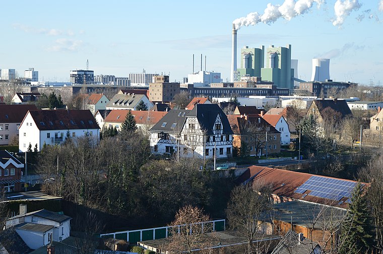
Photo: Olaf2, CC BY-SA 4.0.
Schkopau is a municipality in the Saalekreis district, in Saxony-Anhalt, Germany.
Ammendorf/Beesen
Suburb
Ammendorf/Beesen is a suburb to the south of the city of Halle, Saxony-Anhalt, Germany. It consists of the formerly independent villages of Ammendorf and Beesen.
Steinlache
- Type: River
- Category: body of water
- Location: Schkopau, Saalekreis, Saxony-Anhalt, Germany, Central Europe, Europe
- View on OpenStreetMap
Latitude
51.409° or 51° 24′ 32″ northLongitude
11.9799° or 11° 58′ 48″ eastOpen location code
9F3HCX5H+HWOpenStreetMap ID
way 91757191OpenStreetMap feature
natural=waterOpenStreetMap feature
water=river
This page is based on OpenStreetMap, Wikidata, and Wikimedia Commons.
We’d love your help improving our open data sources. Thank you for contributing.
Satellite Map
Discover Steinlache from above in high-definition satellite imagery.
Places with the Same Name
Discover other places named “Steinlache”.
Localities in the Area
Explore places such as Korbetha and Planena.
Notable Places Nearby
Highlights include W15 and Schießplatz.
Saxony-Anhalt: Must-Visit Destinations
Delve into Magdeburg, Halle, Wittenberg, and Quedlinburg.
Curious Rivers to Discover
Uncover intriguing rivers from every corner of the globe.
About Mapcarta. Data © OpenStreetMap contributors and available under the Open Database License". Text is available under the CC BY-SA 4.0 license, except for photos, directions, and the map. Photo: GMM, Public domain.