Zappi Building
Zappi Building is an industrial building in St. Louis, St. Louis Area, Missouri which is located on Gratiot Street. Zappi Building is situated nearby to the church Maronite Catholic Pastoral Center, as well as near Cedars Banquet Hall.| Tap on a place to explore it |
Places of Interest Nearby
Highlights include Enterprise Center and Busch Stadium.
Enterprise Center
Stadium
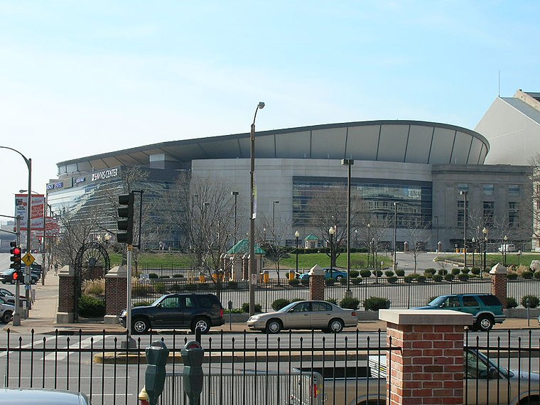
Photo: Haaron755, CC BY-SA 3.0.
Enterprise Center is an 18,096-seat arena located in downtown St. Louis, Missouri, United States. Its primary tenant is the St. Louis Blues of the National Hockey League, but it is also used for other functions, such as NCAA basketball, NCAA hockey, concerts, professional wrestling and more. Enterprise Center is situated 2,100 feet north of Zappi Building.
Busch Stadium
Stadium

Photo: redlegsfan21, CC BY-SA 2.0.
Busch Stadium is a baseball stadium located in St. Louis, Missouri, United States. It is the home of Major League Baseball's St. Louis Cardinals. It has a seating capacity of 44,383, with 3,706 club seats and 61 luxury suites. Busch Stadium is situated 2,400 feet east of Zappi Building.
Gateway Transportation Center
Railway station

Photo: Chris Yunker, CC BY-SA 2.0.
The Gateway Multimodal Transportation Center, also known as Gateway Station, is a rail and bus terminal station in the Downtown West neighborhood of St. Louis, Missouri. Gateway Transportation Center is situated 1,300 feet northwest of Zappi Building.
Places in the Area
Nearby places include LaSalle Park and Peabody–Darst–Webbe.
LaSalle Park
Neighborhood
LaSalle Park is an integral part of the three-neighborhood "Old Frenchtown" area—LaSalle Park, Lafayette Square and Soulard—bordering the southern edge of downtown St. Louis.
Peabody–Darst–Webbe
Neighborhood
Peabody–Darst–Webbe is a neighborhood of St. Louis, Missouri. It is also called the Near Southside neighborhood. Peabody–Darst–Webbe is an area bounded by S.
Downtown West
Neighborhood
Downtown West is a neighborhood in St. Louis, Missouri. It is, as the name suggests, a section of downtown that is further inland, west from the banks of the Mississippi River.
Zappi Building
- Type: Industrial building
- Address: 1219 Gratiot Street, Saint Louis, MO 63103
- Categories: building and industry
- Location: St. Louis, St. Louis Area, Missouri, Midwest, United States, North America
- View on OpenStreetMap
Latitude
38.62123° or 38° 37′ 16″ northLongitude
-90.20139° or 90° 12′ 5″ westLevels
3Open location code
86CFJQCX+FCOpenStreetMap ID
way 919361830OpenStreetMap feature
building=industrial
This page is based on OpenStreetMap, Wikidata, and Wikimedia Commons.
We’d love your help improving our open data sources. Thank you for contributing.
Satellite Map
Discover Zappi Building from above in high-definition satellite imagery.
Notable Places Nearby
Highlights include Maronite Catholic Pastoral Center and Cedars Banquet Hall.
Nearby Places
Explore places such as City Block 418 and Nestlé Purina.
St. Louis Area: Must-Visit Destinations
Delve into Ferguson, St. Charles, and St. Louis County.
Curious Industrial Buildings to Discover
Uncover intriguing industrial buildings from every corner of the globe.
About Mapcarta. Data © OpenStreetMap contributors and available under the Open Database License". Text is available under the CC BY-SA 4.0 license, except for photos, directions, and the map. Photo: pdsphil, CC BY-SA 2.0.