COLEGIO REPUBLICA DE HAITI
COLEGIO REPUBLICA DE HAITI is a school building in San Vicente, Asunción. COLEGIO REPUBLICA DE HAITI is situated nearby to the church Parroquia San Juan Nam, as well as near the bus station Terminal Puerto Elsa.| Tap on a place to explore it |
Places of Interest Nearby
Highlights include Estadio Rogelio Livieres and Estadio General Pablo Rojas.
Estadio Rogelio Livieres
Pitch
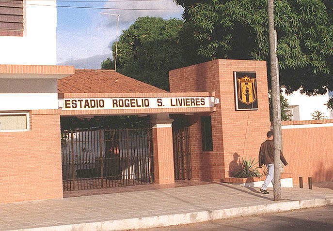
Photo: Edgar Andino, Public domain.
Estadio Rogelio Livieres is a multi-use stadium in Asunción, Paraguay. It is currently used mostly for football matches and is the home stadium of Club Guaraní. The stadium holds 8,000 people. Estadio Rogelio Livieres is situated 750 metres northeast of COLEGIO REPUBLICA DE HAITI.
Estadio General Pablo Rojas
Stadium

Photo: Baiji, Public domain.
Estadio General Pablo Rojas, locally known as La Olla or La Nueva Olla and for sponsorship reasons known as Estadio ueno La Nueva Olla, is a football stadium in the neighbourhood of Barrio Obrero in Asunción, Paraguay. Estadio General Pablo Rojas is situated 2 km northwest of COLEGIO REPUBLICA DE HAITI.
Iglesia San Nicolás y Santa Maria
Church

Photo: Roque curi1, Public domain.
Iglesia San Nicolás y Santa Maria is a church, which is situated 2 km southwest of COLEGIO REPUBLICA DE HAITI.
Places in the Area
Nearby places include Pinozá and Pettirossi.
Pettirossi
Neighborhood
Pettirossi is a neighbourhood of Asunción, the capital and largest city of Paraguay.
COLEGIO REPUBLICA DE HAITI
- Type: School building
- Categories: building and education
- Location: San Vicente, Asunción, Southern Paraneña, Paraguay, South America
- View on OpenStreetMap
Latitude
-25.30871° or 25° 18′ 31″ southLongitude
-57.62073° or 57° 37′ 15″ westOpen location code
5864M9RH+GPOpenStreetMap ID
way 923218990OpenStreetMap feature
building=school
This page is based on OpenStreetMap, Wikidata, and Wikimedia Commons.
We’d love your help improving our open data sources. Thank you for contributing.
Satellite Map
Discover COLEGIO REPUBLICA DE HAITI from above in high-definition satellite imagery.
Notable Places Nearby
Highlights include Parroquia San Juan Nam and Terminal Puerto Elsa.
Nearby Places
Explore places such as Consulado de Kazakhstan and La Choppería del Patrón.
Southern Paraneña: Must-Visit Destinations
Delve into Pilar, Areguá, Villeta, and Ypacarai.
Curious Places to Discover
Uncover intriguing places from every corner of the globe.
About Mapcarta. Data © OpenStreetMap contributors and available under the Open Database License". Text is available under the CC BY-SA 4.0 license, except for photos, directions, and the map. Photo: FF MM, CC BY-SA 3.0.