Основна школа „Миливоје Боровић”
Основна школа „Миливоје Боровић” is a school building in Opština Čajetina, Zlatibor District, Central Serbia which is located on Дринске дивизије. Основна школа „Миливоје Боровић” is situated nearby to the church Српска православна црква Светог пророка Илије, as well as near the village Mačkat.| Tap on a place to explore it |
- Type: School building
- Also known as: “Osnovna skola „Milivoje Borovic””
- Address: Дринске дивизије 4
Places of Interest Nearby
Highlights include Crkva Sv. Marine.
Crkva Sv. Marine
Church

Photo: Ванилица, CC BY-SA 4.0.
Crkva Sv. Marine is a church, which is situated 3 km southeast of Основна школа „Миливоје Боровић”.
Places in the Area
Nearby places include Mačkat and Kriva Reka.
Mačkat
Village
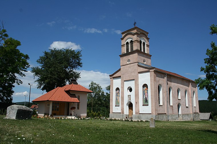
Photo: Ванилица, CC BY-SA 4.0.
Mačkat is a village in Serbia situated in the municipality of Čajetina, and the district of Zlatibor. As of 2011, it has a population of 905 inhabitants.
Kriva Reka
Village

Photo: Ванилица, CC BY-SA 4.0.
Kriva Reka is a village in the municipality of Čajetina, western Serbia. According to the 2011 census, the village has a population of 1,157 people. Kriva Reka is situated 2½ km southeast of Основна школа „Миливоје Боровић”.
Kačer
Village
Kačer is a village located in the Užice municipality of Serbia. In the 2002 census, the village had a population of 507. Kačer is situated 3 km north of Основна школа „Миливоје Боровић”.
Основна школа „Миливоје Боровић”
- Categories: building and education
- Location: Opština Čajetina, Zlatibor District, Central Serbia, Serbia, Balkans, Europe
- View on OpenStreetMap
Latitude
43.79386° or 43° 47′ 38″ northLongitude
19.78054° or 19° 46′ 50″ eastOpen location code
8FMXQQVJ+G6OpenStreetMap ID
way 926160834OpenStreetMap feature
building=school
This page is based on OpenStreetMap, Wikidata, and Wikimedia Commons.
We’d love your help improving our open data sources. Thank you for contributing.
Satellite Map
Discover Основна школа „Миливоје Боровић” from above in high-definition satellite imagery.
Places with the Same Name
Discover other places named “Основна школа „Миливоје Боровић””.
Notable Places Nearby
Highlights include Српска православна црква Светог пророка Илије and 31312 Мачкат.
Nearby Places
Explore places such as Бајо and ЕКО Петрол.
Serbia: Must-Visit Destinations
Delve into Belgrade, Novi Sad, Niš, and Kragujevac.
Curious Places to Discover
Uncover intriguing places from every corner of the globe.
About Mapcarta. Data © OpenStreetMap contributors and available under the Open Database License". Text is available under the CC BY-SA 4.0 license, except for photos, directions, and the map. Photo: Wikimedia, CC0.