Hart (Arnoldstein) Hart im Gailtal
Hart (Arnoldstein) Hart im Gailtal is a shelter in Arnoldstein, Villach-Land District, Carinthia. Hart (Arnoldstein) Hart im Gailtal is situated nearby to JuYoga, as well as near the church Hl. Anna.| Tap on a place to explore it |
Places of Interest Nearby
Highlights include St. Leonhard bei Siebenbrünn and Riegersdorfer Kapelle.
St. Leonhard bei Siebenbrünn
Church
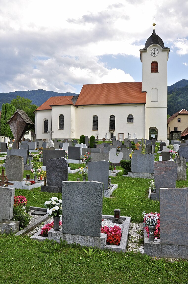
Photo: Johann Jaritz, CC BY-SA 3.0 at.
St. Leonhard bei Siebenbrünn is a church, which is situated 1 km south of Hart (Arnoldstein) Hart im Gailtal.
Riegersdorfer Kapelle
Church

Photo: Johann Jaritz, CC BY-SA 3.0 at.
Riegersdorfer Kapelle is a church, which is situated 1¼ km southwest of Hart (Arnoldstein) Hart im Gailtal.
Hl. Oswald
Church

Photo: Johann Jaritz, CC BY-SA 4.0.
Hl. Oswald is a church, which is situated 1½ km southwest of Hart (Arnoldstein) Hart im Gailtal.
Places in the Area
Nearby places include Fürnitz and Pöckau.

Pöckau
Village

Photo: Johann Jaritz, CC BY-SA 3.0 at.
Pöckau is a village, which is situated 3½ km west of Hart (Arnoldstein) Hart im Gailtal.
Gödersdorf
Village

Photo: Johann Jaritz, CC BY-SA 4.0.
Gödersdorf is a village, which is situated 4½ km east of Hart (Arnoldstein) Hart im Gailtal.
Hart (Arnoldstein) Hart im Gailtal
- Type: Shelter
- Location: Arnoldstein, Villach-Land District, Carinthia, Austria, Central Europe, Europe
- View on OpenStreetMap
Latitude
46.55588° or 46° 33′ 21″ northLongitude
13.79205° or 13° 47′ 31″ eastOpen location code
8FRMHQ4R+9ROpenStreetMap ID
way 930798292OpenStreetMap feature
amenity=shelter
This page is based on OpenStreetMap, Wikidata, and Wikimedia Commons.
We’d love your help improving our open data sources. Thank you for contributing.
Satellite Map
Discover Hart (Arnoldstein) Hart im Gailtal from above in high-definition satellite imagery.
Places with the Same Name
Discover other places named “Hart (Arnoldstein) Hart im Gailtal”.
Notable Places Nearby
Highlights include JuYoga and Hl. Anna.
Nearby Places
Explore places such as Hart (Arnoldstein) Hart im Gailtal and LEBENSBAUM PRAXISGEMEINSCHAFT.
Carinthia: Must-Visit Destinations
Delve into Klagenfurt, Villach, Wörthersee, and Spittal an der Drau.
Curious Shelters to Discover
Uncover intriguing shelters from every corner of the globe.
About Mapcarta. Data © OpenStreetMap contributors and available under the Open Database License". Text is available under the CC BY-SA 4.0 license, except for photos, directions, and the map. Photo: Wikimedia, CC BY-SA 3.0.