Baggot St Hospital
Baggot St Hospital is a hospital in Dublin, Leinster. Baggot St Hospital is situated nearby to Baggot Street Upper Post Office, as well as near Mespil Hotel.| Tap on a place to explore it |
Places of Interest Nearby
Highlights include Aviva Stadium and Embassy of Lesotho in Ireland.
Aviva Stadium
Stadium

Photo: Tarafuku10, Public domain.
Aviva Stadium, formerly Lansdowne Road and also known as the Dublin Arena, is a sports stadium located in Dublin, Ireland. It has a capacity of 51,711. Aviva Stadium is situated 1 km east of Baggot St Hospital.
Embassy of Lesotho in Ireland
Embassy

Photo: ClaireWhi, CC BY-SA 4.0.
Embassy of Lesotho in Ireland is situated 180 metres northwest of Baggot St Hospital.
National Library of Ireland
Library
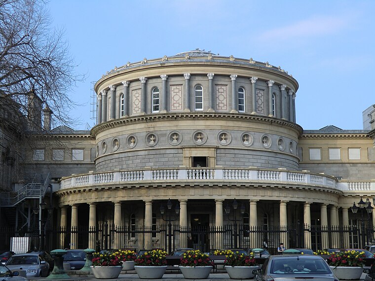
Photo: YvonneM, CC BY-SA 3.0.
The National Library of Ireland is Ireland's national library located in Dublin, in a building designed by Thomas Newenham Deane. The mission of the National Library of Ireland is "To collect, preserve, promote and make accessible the documentary and… National Library of Ireland is situated 1 km northwest of Baggot St Hospital.
Places in the Area
Nearby places include Ballsbridge and Ranelagh.
Ballsbridge
Suburb

Photo: Sarah777, Public domain.
Ballsbridge is an affluent neighbourhood of the city of Dublin, Ireland. The area is largely situated north and west of a three-arch stone bridge across the River Dodder, on the south side of the city.
Ranelagh
Suburb

Photo: Cqui, CC BY-SA 3.0.
Ranelagh is an affluent residential area and urban village on the Southside of Dublin, Ireland in the postal district of Dublin 6. Ranelagh was originally a village called Cullenswood.
Donnybrook
Suburb

Photo: Sarah777, Public domain.
Donnybrook is a district of Dublin, Ireland, on the southside of the city, in the Dublin 4 postal district. It is home to the Irish public service broadcaster Raidió Teilifís Éireann and was once part of the Pembroke Township.
Baggot St Hospital
- Type: Hospital
- Category: health care
- Location: Dublin, Leinster, Ireland, Britain and Ireland, Europe
- View on OpenStreetMap
Latitude
53.33398° or 53° 20′ 2″ northLongitude
-6.24408° or 6° 14′ 39″ westOperator
Health Service ExecutiveOpen location code
9C5M8QM4+H9OpenStreetMap ID
way 935362442OpenStreetMap feature
amenity=hospitalOpenStreetMap feature
healthcare=hospital
This page is based on OpenStreetMap, Wikidata, and Wikimedia Commons.
We’d love your help improving our open data sources. Thank you for contributing.
Satellite Map
Discover Baggot St Hospital from above in high-definition satellite imagery.
Notable Places Nearby
Highlights include Baggot Street Upper Post Office and Mespil Hotel.
Nearby Places
Explore places such as Craft Dry Cleaners and Subway.
Ireland: Must-Visit Destinations
Delve into Cork, Limerick, Galway, and Waterford.
Curious Places to Discover
Uncover intriguing places from every corner of the globe.
About Mapcarta. Data © OpenStreetMap contributors and available under the Open Database License". Text is available under the CC BY-SA 4.0 license, except for photos, directions, and the map. Photo: Wikimedia, CC0.