Serenity
Serenity is a residential area in Calvià, Balearic Islands. Serenity is situated nearby to the grassland Rotonda de les Columnes, as well as near the beach Platja de ses Penyes Roges.| Tap on a place to explore it |
Places of Interest Nearby
Highlights include Platja del Toro and Puig de Sa Morisca.

Puig de Sa Morisca
Archaeological site

Photo: Fullet, CC BY-SA 3.0.
Puig de Sa Morisca is an archaeological site, which is situated 1¼ km north of Serenity.
Puig de Sa Morisca (archaeological park)
Archaeological site
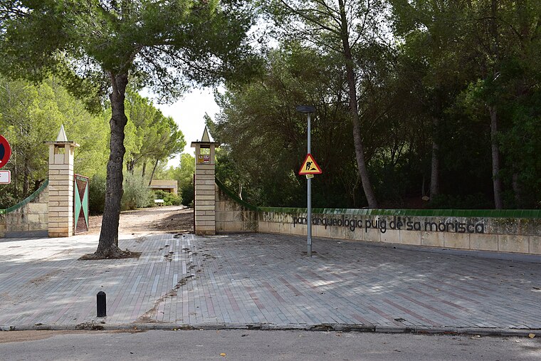
Photo: Dreizung, CC BY-SA 4.0.
The Puig de sa Morisca Archaeological Park is located in Santa Ponsa in the municipality of Calvià on the island of Majorca, part of the Spanish autonomous community of the Balearic Islands. Puig de Sa Morisca (archaeological park) is situated 1½ km northeast of Serenity.
Places in the Area
Nearby places include El Toro and Son Ferrer.
El Toro
Suburb
El Toro is a neighborhood in the municipality of Calvià on the island of Majorca, part of the Spanish autonomous community of the Balearic Islands. It is located in an area known as Ses Penyes Rotges.
Son Ferrer
Suburb

Photo: Wikimedia, CC BY-SA 3.0.
Son Ferrer is a new village in the municipality of Calvià on the island of Majorca, part of the Spanish autonomous community of the Balearic Islands. Son Ferrer is located about 20 km from the capital, Palma de Mallorca.
Santa Ponsa
Town
 Santa Ponsa is a small town in the southwest of Mallorca. Located in the municipality of Calvià, it is 18 kilometres from the capital Palma.
Serenity
- Type: Residential area
- Location: Calvià, Balearic Islands, Spain, Iberia, Europe
- View on OpenStreetMap
Latitude
39.49613° or 39° 29′ 46″ northLongitude
2.47854° or 2° 28′ 43″ eastOpen location code
8FF4FFWH+FCOpenStreetMap ID
way 936237144OpenStreetMap feature
landuse=residential
This page is based on OpenStreetMap, Wikidata, and Wikimedia Commons.
We’d love your help improving our open data sources. Thank you for contributing.
Satellite Map
Discover Serenity from above in high-definition satellite imagery.
Places with the Same Name
Discover other places named “Serenity”.
Notable Places Nearby
Highlights include Rotonda de les Columnes and Platja de ses Penyes Roges.
Nearby Places
Explore places such as 1 and Residencial Ses Penyes Rotges.
Balearic Islands: Must-Visit Destinations
Delve into Palma de Mallorca, Formentera, Ibiza, and Maó.
Curious Residential Areas to Discover
Uncover intriguing residential areas from every corner of the globe.
About Mapcarta. Data © OpenStreetMap contributors and available under the Open Database License". Text is available under the CC BY-SA 4.0 license, except for photos, directions, and the map. Photo: anieto2k, CC BY-SA 2.0.