Dominkanerkonvent „Maria de Victoria“
Dominkanerkonvent „Maria de Victoria“ is a church in Vechta, Lower Saxony. Dominkanerkonvent „Maria de Victoria“ is situated nearby to the school Kolleg St. Thomas der Dominikaner, as well as near the church Klosterkirche Füchtel.| Tap on a place to explore it |
Places of Interest Nearby
Highlights include Kolleg St. Thomas der Dominikaner and Gulf house.
Kolleg St. Thomas der Dominikaner
School
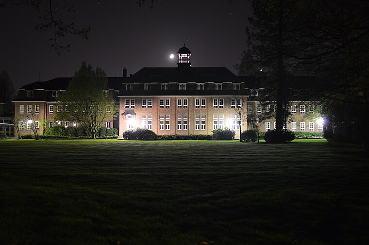
Photo: Kony1337, CC BY-SA 4.0.
Kolleg St. Thomas der Dominikaner is a school.
Gulf house
Community center

Photo: Gouwenaar, Public domain.
A Gulf house, also called a Gulf farmhouse or East Frisian house, is a type of byre-dwelling that emerged in the 16th and 17th centuries in North Germany. Gulf house is situated 1½ km west of Dominkanerkonvent „Maria de Victoria“.
Vechta station
Railway station
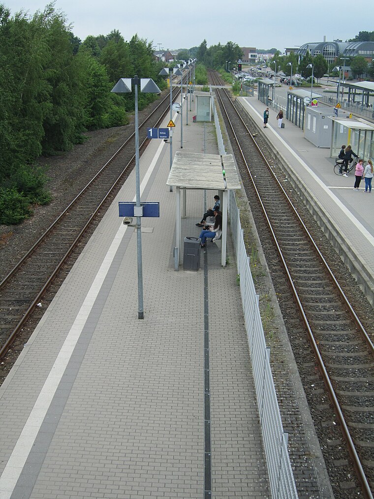
Photo: Corradox, CC BY-SA 4.0.
Vechta is a railway station located in Vechta, Germany. The station opened on 1 October 1885 and is located on the Delmenhorst–Hesepe railway. The train services are operated by NordWestBahn. Vechta station is situated 1½ km west of Dominkanerkonvent „Maria de Victoria“.
Places in the Area
Nearby places include Vechta and Langförden.
Vechta
Town

Photo: Corradox, CC BY-SA 3.0.
Vechta is the capital and largest city of the Vechta district in Lower Saxony, Germany. It is home to the University of Vechta. It is known for the 'Stoppelmarkt' fair, which takes place every summer and has a history dating back to 1298.
Langförden
Suburb

Photo: Corradox, CC BY-SA 3.0.
Langförden is a suburb, which is situated 7 km northwest of Dominkanerkonvent „Maria de Victoria“.
Bakum
Village

Photo: Corradox, CC BY-SA 3.0.
Bakum is a municipality in the district of Vechta, in Lower Saxony, Germany. It is situated in the Vechta district in western Lower Saxony. Bakum lies on the A1 freeway between Bremen and Osnabrück. Bakum is situated 8 km west of Dominkanerkonvent „Maria de Victoria“.
Dominkanerkonvent „Maria de Victoria“
- Type: Church
- Wheelchair access: limited
- Categories: place of worship and religion
- Location: Vechta, Lower Saxony, Germany, Central Europe, Europe
- View on OpenStreetMap
Latitude
52.72864° or 52° 43′ 43″ northLongitude
8.30178° or 8° 18′ 6″ eastOpen location code
9F4CP8H2+FPOpenStreetMap ID
way 93774191OpenStreetMap feature
amenity=place_of_worshipOpenStreetMap attribute
wheelchair=limited
This page is based on OpenStreetMap, Wikidata, and Wikimedia Commons.
We’d love your help improving our open data sources. Thank you for contributing.
Satellite Map
Discover Dominkanerkonvent „Maria de Victoria“ from above in high-definition satellite imagery.
Notable Places Nearby
Highlights include Klosterkirche Füchtel and Gebäude J Universität Vechta.
Nearby Places
Explore places such as J and Pater-Titus-Stift.
Lower Saxony: Must-Visit Destinations
Delve into Hanover, Göttingen, Brunswick, and Wolfsburg.
Curious Churches to Discover
Uncover intriguing churches from every corner of the globe.
About Mapcarta. Data © OpenStreetMap contributors and available under the Open Database License". Text is available under the CC BY-SA 4.0 license, except for photos, directions, and the map. Photo: Danapit, CC BY-SA 3.0.