Recinte multisuos
Recinte multisuos is an event venue in Onda, Castellón, Valencian Community which is located on Calle Torrechiva. Recinte multisuos is situated nearby to the stadium Olímpic d’Onda, as well as near La Serratella.| Tap on a place to explore it |
Places of Interest Nearby
Highlights include La Serratella and Onda Castle.
La Serratella
Stadium
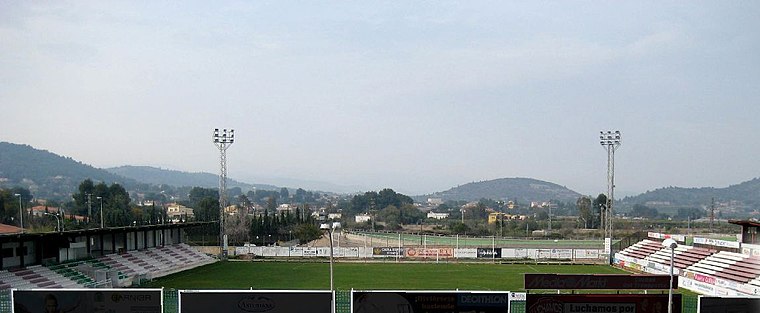 La Serratella is a stadium, which is situated 160 metres east of Recinte multisuos.
Onda Castle
Castle

Photo: Enfo, CC BY-SA 3.0.
Onda Castle is situated 1 km southeast of Recinte multisuos.
Church of the Assumption
Church

Photo: Joanbanjo, CC BY-SA 3.0.
Church of the Assumption is situated 1 km southeast of Recinte multisuos.
Places in the Area
Nearby places include Onda and Pont de Sonella.
Onda
Town

Photo: Columbusalbus, CC BY-SA 4.0.
Onda is a town in eastern Spain, in the province of Castelló, part of the autonomous community of Valencia. It has 24,859 inhabitants. The Sitjar dam, located close to Onda, is an important feature for the irrigation of the nearby fields with water from the Millars River.

Tales
Village

Photo: Wikimedia, CC BY-SA 3.0.
Tales is a municipality located in the province of Castellón, Valencian Community, Spain. Tales is situated 4 km southwest of Recinte multisuos.
Recinte multisuos
- Type: Event venue
- Address: Calle Torrechiva, Onda, 12200
- Location: Onda, Castellón, Valencian Community, Eastern Spain, Spain, Iberia, Europe
- View on OpenStreetMap
Latitude
39.96879° or 39° 58′ 8″ northLongitude
-0.26837° or 0° 16′ 6″ westOperator
Ajuntament d’OndaOpen location code
8CFXXP9J+GMOpenStreetMap ID
way 938771073OpenStreetMap feature
amenity=events_venue
This page is based on OpenStreetMap, Wikidata, and Wikimedia Commons.
We’d love your help improving our open data sources. Thank you for contributing.
Satellite Map
Discover Recinte multisuos from above in high-definition satellite imagery.
In Other Languages
From Catalan to Spanish—“Recinte multisuos” goes by many names.
- Catalan: “Recinte multisuos”
- Spanish: “Recinto multiusos”
Notable Places Nearby
Highlights include Olímpic d’Onda and Casal Jove Onda.
Nearby Places
Explore places such as Dia and Col·legi d’Educació Infantil i Primària Baltasar Rull.
Castellón: Must-Visit Destinations
Delve into Castellón, Villarreal, Peñiscola, and Segorbe.
Curious Event Venues to Discover
Uncover intriguing event venues from every corner of the globe.
About Mapcarta. Data © OpenStreetMap contributors and available under the Open Database License". Text is available under the CC BY-SA 4.0 license, except for photos, directions, and the map. Photo: Dorieo, CC BY-SA 4.0.