Longboats
Longboats is a pub in County Cork, Munster which is located on Blackrock Road. Longboats is situated nearby to Ballintemple Post Office, as well as near the church Ardfoyle Convent.| Tap on a place to explore it |
- Type: Pub
- Also known as: “Temple Inn”
- Address: 36-37 Blackrock Road, Ballintemple, Cork, T12 TX38
- Roof shape: gabled
Places of Interest Nearby
Highlights include Páirc Uí Rinn and Cork Kent.
Páirc Uí Rinn
Stadium
Páirc Uí Rinn, also known as Páirc Chríostóir Uí Rinn, is a Gaelic Athletic Association stadium located between Ballinlough and Ballintemple in Cork. It was previously known as Flower Lodge and was used as an association football stadium. Páirc Uí Rinn is situated 630 metres southwest of Longboats.
Cork Kent
Railway station
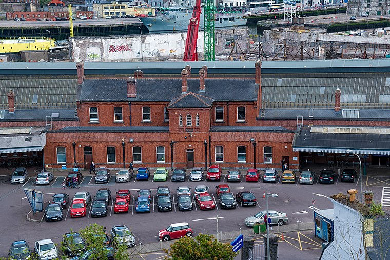
Photo: Jonjobaker, CC BY-SA 4.0.
Kent Station is an Iarnród Éireann railway station in Cork, Ireland. Originally opened in 1893, the station operates as a hub for Intercity services to Dublin and Tralee and commuter services to Mallow, Cobh and Midleton. Cork Kent is situated 2 km west of Longboats.
St Michael’s Church
Church

Photo: Michael O’Sheil, CC BY-SA 4.0.
St Michael’s Church is situated 1 km east of Longboats.
Places in the Area
Nearby places include Ballintemple and Tivoli.
Ballintemple
Suburb
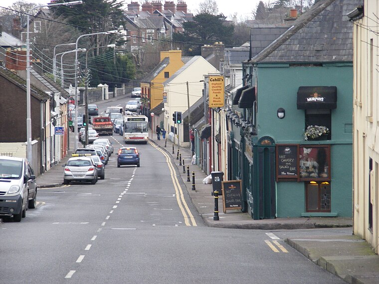
Photo: Cdbrock, CC BY-SA 3.0.
Ballintemple is a suburb of Cork city, Ireland. The village is situated on the east side of the city with its limits extending to the River Lee and the village of Blackrock further to the east.
Tivoli
Locality

Photo: K.ristof, CC BY-SA 3.0.
Tivoli is an eastern suburb of Cork in Ireland. Tivoli is in the Dáil constituency of Cork North-Central. A station on the former Cork and Youghal Railway served the area between the 1860s and 1930s.
Ballinlough
Suburb
Ballinlough is a mainly residential townland and suburb on the southside of Cork city, in Ireland. It is located between Ballintemple and the larger suburbs of Douglas and Blackrock.
Longboats
- Categories: building and retail building
- Location: County Cork, Munster, Southwest Ireland, Ireland, Britain and Ireland, Europe
- View on OpenStreetMap
Latitude
51.89604° or 51° 53′ 46″ northLongitude
-8.43157° or 8° 25′ 54″ westLevels
3Open location code
9C3HVHW9+C9OpenStreetMap ID
way 939272077OpenStreetMap feature
amenity=pubOpenStreetMap feature
building=retailOpenStreetMap attribute
roof-shape=gabled
This page is based on OpenStreetMap, Wikidata, and Wikimedia Commons.
We’d love your help improving our open data sources. Thank you for contributing.
Satellite Map
Discover Longboats from above in high-definition satellite imagery.
Notable Places Nearby
Highlights include Ballintemple Post Office and Ardfoyle Convent.
Nearby Places
Explore places such as The Temple Inn and Ardfoyle Place.
County Cork: Must-Visit Destinations
Delve into Cork, Cobh, Kinsale, and Mallow.
Curious Pubs to Discover
Uncover intriguing pubs from every corner of the globe.
About Mapcarta. Data © OpenStreetMap contributors and available under the Open Database License". Text is available under the CC BY-SA 4.0 license, except for photos, directions, and the map. Photo: Wikimedia, CC BY-SA 3.0.