Staatliches Schulamt Freiburg
Staatliches Schulamt Freiburg is a school building in Freiburg im Breisgau, Freiburg, Baden-Württemberg which is located on Oltmannsstraße. Staatliches Schulamt Freiburg is situated nearby to the arts center ZONE e.V., as well as near the sports venue Fitness Gym.| Tap on a place to explore it |
- Type: School building
- Address: Oltmannsstraße 22, Freiburg im Breisgau, 79100
- Roof shape: flat
Places of Interest Nearby
Highlights include Die Laufenden and KTS.
Die Laufenden
Work of art

Photo: Joergens.mi, CC BY-SA 3.0.
Die Laufenden is a work of art, which is situated 200 metres southeast of Staatliches Schulamt Freiburg.
KTS
Community center
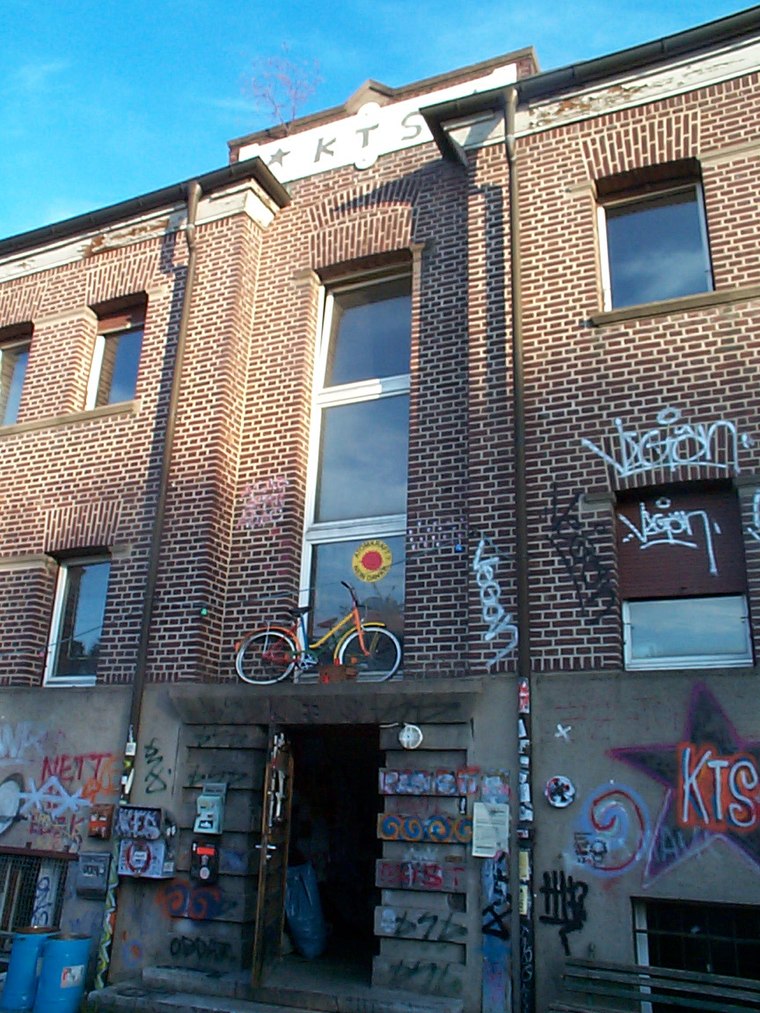
Photo: Wikimedia, CC BY-SA 3.0.
KTS is a community center, which is situated 700 metres north of Staatliches Schulamt Freiburg.
Hildaturm
Scenic viewpoint

Photo: Joergens.mi, CC BY-SA 3.0.
Hildaturm is a scenic viewpoint, which is situated 700 metres east of Staatliches Schulamt Freiburg.
Places in the Area
Nearby places include Vauban and Haslach.
Vauban
Suburb
 Vauban is a neighbourhood to the south of the town centre in Freiburg, Germany. It was built as "a sustainable model district" on the site of a former French military base named after Sébastien Le Prestre de Vauban, the 17th century French Marshal who built fortifications in Freiburg while the region was under French rule.
Haslach
Suburb
Haslach, incorporated into the city on 1 January 1890, is one of the Western districts of Freiburg im Breisgau. After the demerging of Weingarten the district is made up out of the boroughs 611 Haslach-Egerten, 612 Haslach-Gartenstadt, 613 Haslach-Schildacker and 614 Haslach-Haid.
Wiehre
Suburb
Wiehre is a residential district at the edge of Freiburg im Breisgau, located southwards and across the River Dreisam from the Old City. It is a desirable district, with comparatively quiet streets and many well-preserved commercial and residential buildings dating from the 18th century and earlier.
Staatliches Schulamt Freiburg
- Categories: building and education
- Location: Freiburg im Breisgau, Freiburg, Freiburg Region, Black Forest, Baden-Württemberg, Germany, Central Europe, Europe
- View on OpenStreetMap
Latitude
47.97995° or 47° 58′ 48″ northLongitude
7.82856° or 7° 49′ 43″ eastLevels
3Open location code
8FV9XRHH+XCOpenStreetMap ID
way 94348054OpenStreetMap feature
building=schoolOpenStreetMap attribute
roof-shape=flat
This page is based on OpenStreetMap, Wikidata, and Wikimedia Commons.
We’d love your help improving our open data sources. Thank you for contributing.
Satellite Map
Discover Staatliches Schulamt Freiburg from above in high-definition satellite imagery.
In Other Languages
“Staatliches Schulamt Freiburg” goes by many names.
Notable Places Nearby
Highlights include ZONE e.V. and Fitness Gym.
Nearby Places
Explore places such as Staatliches Seminar für Didaktik und Lehrerbildung (Gymnasien und Sonderpädagogik) and Citydruck Freiburg.
Black Forest: Must-Visit Destinations
Delve into Baden-Baden, Pforzheim, Villingen-Schwenningen, and Offenburg.
Curious Schools to Discover
Uncover intriguing schools from every corner of the globe.
About Mapcarta. Data © OpenStreetMap contributors and available under the Open Database License". Text is available under the CC BY-SA 4.0 license, except for photos, directions, and the map. Photo: Jjtkk, CC BY-SA 3.0.