Münsterfeld Stein- und Baustofflager
Münsterfeld Stein- und Baustofflager is a landfill in Fulda, Kassel, Hesse. Münsterfeld Stein- und Baustofflager is situated nearby to the government office Autobahn GmbH Außenstelle Fulda, as well as near the church Gloria International Ministries.| Tap on a place to explore it |
Places of Interest Nearby
Highlights include Kreuzkirche Fulda and Fulda Cathedral.
Kreuzkirche Fulda
Church

Photo: Wikimedia, Copyrighted free use.
Kreuzkirche Fulda is a church, which is situated 1¼ km southeast of Münsterfeld Stein- und Baustofflager.
Fulda Cathedral
Church
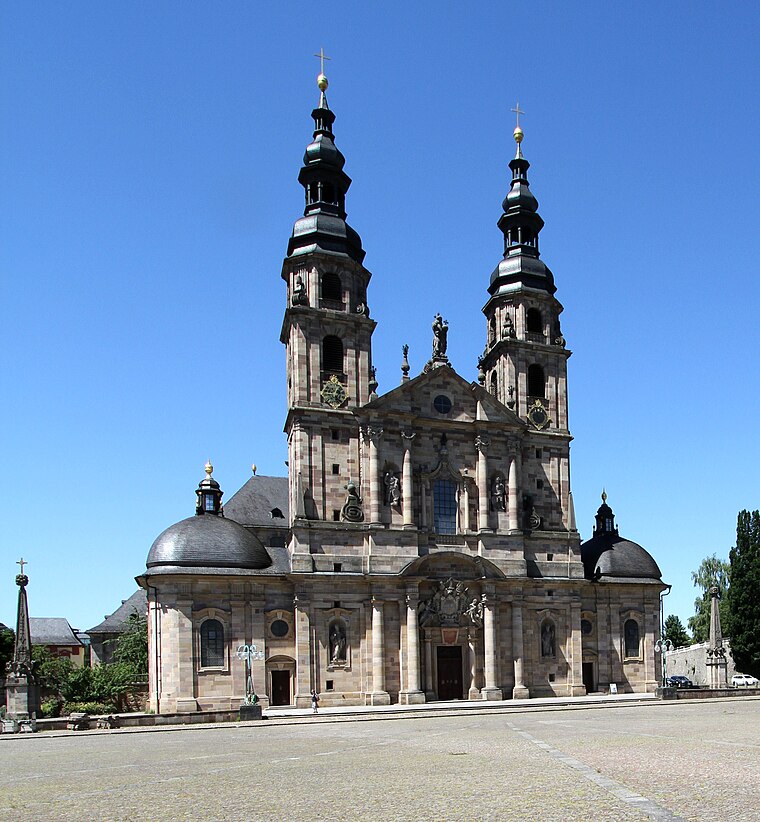
Photo: Gerd Eichmann, CC BY-SA 4.0.
Fulda Cathedral is the former abbey church of Fulda Abbey and the burial place of Saint Boniface. Since 1752 it has also been the cathedral of the Diocese of Fulda, of which the Prince-Abbots of Fulda were created bishops. Fulda Cathedral is situated 2½ km east of Münsterfeld Stein- und Baustofflager.

Places in the Area
Nearby places include Fulda-Galerie and Neuenberg.


Münsterfeld Stein- und Baustofflager
- Type: Landfill
- Location: Fulda, Fulda, Kassel, North Hesse, Hesse, Germany, Central Europe, Europe
- View on OpenStreetMap
Latitude
50.55512° or 50° 33′ 18″ northLongitude
9.63913° or 9° 38′ 21″ eastOpen location code
9F2FHJ4Q+2MOpenStreetMap ID
way 944781322OpenStreetMap feature
landuse=landfill
This page is based on OpenStreetMap, Wikidata, and Wikimedia Commons.
We’d love your help improving our open data sources. Thank you for contributing.
Satellite Map
Discover Münsterfeld Stein- und Baustofflager from above in high-definition satellite imagery.
Notable Places Nearby
Highlights include Gloria International Ministries and Autobahn GmbH Außenstelle Fulda.
Nearby Places
Explore places such as UTH Maschinenfabrik and Strupp.
North Hesse: Must-Visit Destinations
Delve into Kassel, Wetzlar, Marburg, and Gießen.
Curious Landfills to Discover
Uncover intriguing landfills from every corner of the globe.
About Mapcarta. Data © OpenStreetMap contributors and available under the Open Database License". Text is available under the CC BY-SA 4.0 license, except for photos, directions, and the map. Photo: 4028mdk09, CC BY-SA 3.0.