BP
BP is a gas station in Pennsauken Township, Camden County, New Jersey. BP is situated nearby to the church Living Faith Christian Center, as well as near the hamlet Fork Landing.| Tap on a place to explore it |
Places of Interest Nearby
Highlights include Palmyra station and Pennsauken Transit Center.
Palmyra station
Railway station

Photo: Wmflanagan, CC0.
Palmyra station is a station on the River Line light rail system, located on East Broad Street between in Cinnaminson and Highland Avenues in Palmyra, New Jersey, though its official address is on East Broad Street. Palmyra station is situated 1½ miles north of BP.
Pennsauken Transit Center
Railway station
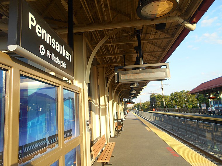
Photo: Wikimedia, CC BY-SA 2.0.
Pennsauken Transit Center is a New Jersey Transit train station in Pennsauken Township, in Camden County, New Jersey, United States. It serves as an intermodal transfer station between the River Line light rail and the Atlantic City Line commuter rail, as well as serving the Delair neighborhood for Pennsauken and the nearby industrial park. Pennsauken Transit Center is situated 2 miles west of BP.
Riverton station
Railway station

Photo: Sanoyes, Public domain.
Riverton station is a station on the River Line light rail system, located along South Broad Street between Thomas Avenue and Main Street in Riverton, New Jersey, though it is officially addressed as being on Main Street. Riverton station is situated 2 miles north of BP.
Places in the Area
Nearby places include Fork Landing and Iron Rock.
Fork Landing
Hamlet
Cinnaminson Township is a township in Burlington County, in the U.S. state of New Jersey. Cinnaminson Township borders the Delaware River, and is an eastern suburb of Philadelphia.
Iron Rock
Hamlet
Pennsauken Township is a township in Camden County, in the Philadelphia Metropolitan Area in the U.S. state of New Jersey, and it is located outside of Philadelphia, Pennsylvania, which it borders directly on the Delaware River.
Palmyra
Village

Photo: Wmflanagan, CC0.
Palmyra is a borough in Burlington County, in the U.S. state of New Jersey. As of the 2020 United States census, the borough's population was 7,438, an increase of 40 from the 2010 census count of 7,398, which in turn reflected an increase of 307 from the 7,091 counted in the 2000 census. Palmyra is situated 2 miles north of BP.
BP
- Type: Gas station
- Category: transportation
- Location: Pennsauken Township, Camden County, Delaware River Region, New Jersey, Mid-Atlantic, United States, North America
- View on OpenStreetMap
Latitude
39.98152° or 39° 58′ 54″ northLongitude
-75.02308° or 75° 1′ 23″ westBrand
BPOpen location code
87F6XXJG+JQOpenStreetMap ID
way 946162067OpenStreetMap feature
amenity=fuel
This page is based on OpenStreetMap, Wikidata, and Wikimedia Commons.
We’d love your help improving our open data sources. Thank you for contributing.
Satellite Map
Discover BP from above in high-definition satellite imagery.
Notable Places Nearby
Highlights include Living Faith Christian Center and Walt Nicgorski Sports Complex.
Nearby Places
Explore places such as BP Shop and Double Nickel Brewing Company.
Camden County: Must-Visit Destinations
Delve into Camden, Haddonfield, Lindenwold, and Runnemede.
Curious Gas Stations to Discover
Uncover intriguing gas stations from every corner of the globe.
About Mapcarta. Data © OpenStreetMap contributors and available under the Open Database License". Text is available under the CC BY-SA 4.0 license, except for photos, directions, and the map. Photo: Wikimedia, CC0.