Ponyaner Reitschule Hannover
Ponyaner Reitschule Hannover is a recreation area in Langenhagen, Hanover Region, Lower Saxony which is located on Hainhäuser Weg. Ponyaner Reitschule Hannover is situated nearby to the church Matthias-Claudius-Kirche, as well as near Reitverein Hubertus Langenhagen.| Tap on a place to explore it |
Places of Interest Nearby
Highlights include Hannover Airport and Langenhagen-Kaltenweide station.
Hannover Airport
Aerodrome

Photo: TeWeBs, CC BY-SA 4.0.
Hannover Airport is the international airport of Hanover, capital of the German state of Lower Saxony. The ninth largest airport in Germany, it is situated on 570 hectares in Langenhagen, 11 kilometres north of the centre of Hanover. Hannover Airport is situated 4 km west of Ponyaner Reitschule Hannover.
Langenhagen-Kaltenweide station
Railway station

Photo: Wikimedia, CC BY-SA 3.0.
Langenhagen-Kaltenweide station is a railway station, which is situated 1 km north of Ponyaner Reitschule Hannover.
Langenhagen Pferdemarkt station
Railway station
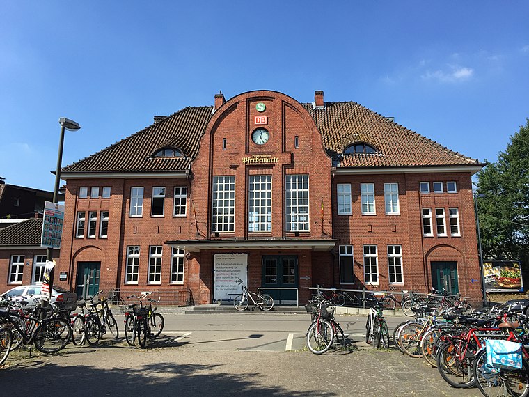
Photo: Nortix08, CC BY-SA 4.0.
Langenhagen Pferdemarkt station is a station in the town of Langenhagen, which lies north of Hanover, the capital of the German state of Lower Saxony. At present it is served by lines S4 and S5 of the Hanover S-Bahn. Langenhagen Pferdemarkt station is situated 2 km south of Ponyaner Reitschule Hannover.
Places in the Area
Nearby places include Kaltenweide and Krähenwinkel.

Langenhagen
Town

Photo: Fischchen, CC BY-SA 3.0.
Langenhagen is a town in the Hanover district of Lower Saxony, Germany. Langenhagen is situated 3 km south of Ponyaner Reitschule Hannover.
Ponyaner Reitschule Hannover
- Type: Equestrianism
- Address: Hainhäuser Weg 8a
- Categories: recreation area and sports location
- Location: Langenhagen, Hanover Region, Lower Saxony, Germany, Central Europe, Europe
- View on OpenStreetMap
Latitude
52.46997° or 52° 28′ 12″ northLongitude
9.73665° or 9° 44′ 12″ eastOpen location code
9F4FFP9P+XMOpenStreetMap ID
way 946968326OpenStreetMap feature
leisure=horse_riding
This page is based on OpenStreetMap, Wikidata, and Wikimedia Commons.
We’d love your help improving our open data sources. Thank you for contributing.
Satellite Map
Discover Ponyaner Reitschule Hannover from above in high-definition satellite imagery.
Notable Places Nearby
Highlights include Matthias-Claudius-Kirche and Reitverein Hubertus Langenhagen.
Nearby Places
Explore places such as Zur Alten Schmiede and Anhänger Vermietung/Verkauf.
Hanover Region: Must-Visit Destinations
Delve into Hanover, Hildesheim, Nienburg, and Verden an der Aller.
Curious Places to Discover
Uncover intriguing places from every corner of the globe.
About Mapcarta. Data © OpenStreetMap contributors and available under the Open Database License". Text is available under the CC BY-SA 4.0 license, except for photos, directions, and the map. Photo: Ukko.de, CC BY-SA 3.0.