Camp Hall
Camp Hall is a school building in Town of Waterbury, Naugatuck Valley Planning Region, Connecticut. Camp Hall is situated nearby to McTernan Centennial Library, as well as near Chase Collegiate School.| Tap on a place to explore it |
Places of Interest Nearby
Highlights include Chase Collegiate School and John F. Kennedy High School.
Chase Collegiate School
School
Chase Collegiate School was a nonsectarian private day school offering education for children from pre-kindergarten through grade 12. The school was on a 47-acre campus in Waterbury, Connecticut. Chase Collegiate School is situated 400 feet southeast of Camp Hall.
John F. Kennedy High School
School
John F. Kennedy High School is a high school, located in the city of Waterbury, Connecticut, United States. U.S. Congresswoman Jahana Hayes was a teacher here, and won National Teacher of the Year in 2016, prior to her successful run for congress in 2018. John F. Kennedy High School is situated 2,500 feet east of Camp Hall.
Waterbury station
Railway station

Photo: Daniel Case, CC BY-SA 3.0.
Waterbury station is a commuter rail stop on the Waterbury Branch of the Metro-North Railroad's New Haven Line, located on Meadow Street in Waterbury, Connecticut. Waterbury station is situated 1¼ miles northeast of Camp Hall.
Places in the Area
Nearby places include Town Plot Hill and Waterbury.
Town Plot Hill
Hamlet
Town Plot is a neighborhood in the west end of the city of Waterbury, Connecticut.
Waterbury

Photo: Daniel Case, CC BY-SA 3.0.
Waterbury is a city in the U.S. state of Connecticut. Waterbury had a population of 114,403 as of the 2020 Census. The city is 33 miles southwest of Hartford and 77 miles northeast of New York City.
Bank Street Historic District
Neighborhood
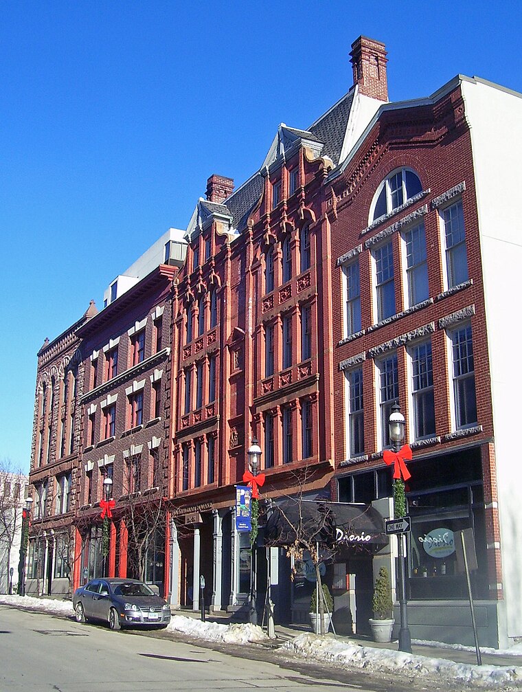
Photo: Daniel Case, CC BY-SA 3.0.
The Bank Street Historic District is a group of four attached brick commercial buildings in different architectural styles on that street in Waterbury, Connecticut, United States.
Camp Hall
- Type: School building
- Categories: building and education
- Location: Town of Waterbury, Naugatuck Valley Planning Region, Connecticut, New England, United States, North America
- View on OpenStreetMap
Latitude
41.54561° or 41° 32′ 44″ northLongitude
-73.06724° or 73° 4′ 2″ westOpen location code
87H8GWWM+64OpenStreetMap ID
way 947105537OpenStreetMap feature
building=school
This page is based on OpenStreetMap, Wikidata, and Wikimedia Commons.
We’d love your help improving our open data sources. Thank you for contributing.
Satellite Map
Discover Camp Hall from above in high-definition satellite imagery.
Places with the Same Name
Discover other places named “Camp Hall”.
Notable Places Nearby
Highlights include McTernan Centennial Library and Saint John’s Lutheran Church.
Nearby Places
Explore places such as Fulkerson Arts Center and Art Annex.
Connecticut: Must-Visit Destinations
Delve into Hartford, New Haven, Bridgeport, and Stamford.
Curious Places to Discover
Uncover intriguing places from every corner of the globe.
About Mapcarta. Data © OpenStreetMap contributors and available under the Open Database License". Text is available under the CC BY-SA 4.0 license, except for photos, directions, and the map. Photo: Wikimedia, CC0.