Smith Brook Open Space
Smith Brook Open Space is a nature reserve in Capitol Planning Region, Connecticut which is located on Overlook Road. Smith Brook Open Space is situated nearby to the hamlet Glastonbury Center, as well as near the neighborhood Hopewell.| Tap on a place to explore it |
Places of Interest
Highlights include Welles-Shipman-Ward House and John Hollister House.
Welles-Shipman-Ward House
Museum

Photo: Wikimedia, Public domain.
The Welles-Shipman-Ward House is a historic house museum at 972 Main Street in South Glastonbury, Connecticut. Built in 1755, it is a well-preserved example of Georgian architecture, with the largest period fireplace in Connecticut.
John Hollister House
Historic building
The John Hollister House is a historic house at 14 Tryon Street in the South Glastonbury village of Glastonbury, Connecticut. Built about 1675, it is the town's oldest surviving colonial structure, built by one of its early settlers.

Places in the Area
Nearby places include Rocky Hill and Glastonbury.
Rocky Hill

Photo: Daderot, CC BY-SA 3.0.
Rocky Hill is a town in Hartford County, Connecticut, United States. The town is part of the Capitol Planning Region. The population was 20,845 at the 2020 census.
Glastonbury
Town
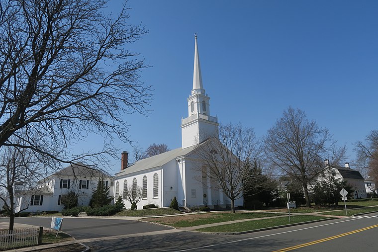
Photo: Faolin42, CC BY-SA 4.0.
Glastonbury is a town in the Capitol Planning Region, Connecticut, United States, formally founded in 1693 and first settled in 1636. It was named after Glastonbury in Somerset, England.
Glastonbury Center
Hamlet

Photo: Faolin42, CC BY-SA 4.0.
Glastonbury Center is a census-designated place that constitutes the densely populated center of Glastonbury in Hartford County, Connecticut, United States. The population was 7,387 at the 2010 census, out of a total town population of 34,427.
Smith Brook Open Space
- Type: Nature reserve
- Address: Overlook Road, Glastonbury, CT 06033
- Category: recreation area
- Location: Capitol Planning Region, Connecticut, New England, United States, North America
- View on OpenStreetMap
Latitude
41.686° or 41° 41′ 9″ northLongitude
-72.5806° or 72° 34′ 50″ westOperator
Town of GlastonburyOpen location code
87H9MCP9+9QOpenStreetMap ID
way 948007053OpenStreetMap feature
leisure=nature_reserve
This page is based on OpenStreetMap, Wikidata, and Wikimedia Commons.
We’d love your help improving our open data sources. Thank you for contributing.
Satellite Map
Discover Smith Brook Open Space from above in high-definition satellite imagery.
Places with the Same Name
Discover other places named “Smith Brook Open Space”.
Localities in the Area
Explore places such as Hopewell and J. B. Williams Co. Historic District.
Notable Places Nearby
Highlights include Orchard Hill Detention Pond and Orchard Hill Club.
Connecticut: Must-Visit Destinations
Delve into Hartford, New Haven, Bridgeport, and Stamford.
Curious Nature Reserves to Discover
Uncover intriguing nature reserves from every corner of the globe.
About Mapcarta. Data © OpenStreetMap contributors and available under the Open Database License". Text is available under the CC BY-SA 4.0 license, except for photos, directions, and the map. Photo: Wikimedia, CC0.