Langhof Schneidtechnik
Langhof Schneidtechnik is an industrial building in Seeg, Ostallgäu, Bavaria which is located on Rothelebuch. Langhof Schneidtechnik is situated nearby to the sports venue TC Seeg, as well as near the fire station Feuerwehr Seeg.| Tap on a place to explore it |
Places of Interest Nearby
Highlights include Seeg railway halt and St. Ulrich.
Seeg railway halt
Railway stop

Photo: Bruno413, CC BY-SA 4.0.
Seeg railway halt is a railway stop, which is situated 440 metres southeast of Langhof Schneidtechnik.
St. Ulrich
Church
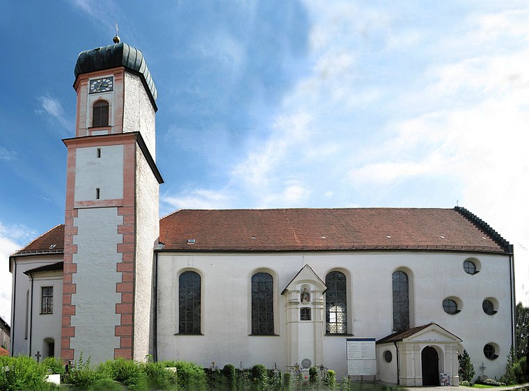
Photo: Kolling, CC BY-SA 3.0.
St. Ulrich is a church, which is situated 1 km southwest of Langhof Schneidtechnik.
Hl. Dreifaltigkeit
Church

Photo: Flodur63, CC BY-SA 3.0.
Hl. Dreifaltigkeit is a church, which is situated 780 metres northeast of Langhof Schneidtechnik.
Places in the Area
Nearby places include Burk and Aufmberg.


Langhof Schneidtechnik
- Type: Industrial building
- Address: Rothelebuch 13
- Categories: building and industry
- Location: Seeg, Ostallgäu, Bavarian Swabia, Bavaria, Germany, Central Europe, Europe
- View on OpenStreetMap
Latitude
47.65947° or 47° 39′ 34″ northLongitude
10.61108° or 10° 36′ 40″ eastOpen location code
8FVGMJ56+QCOpenStreetMap ID
way 953897197OpenStreetMap feature
building=industrial
This page is based on OpenStreetMap, Wikidata, and Wikimedia Commons.
We’d love your help improving our open data sources. Thank you for contributing.
Satellite Map
Discover Langhof Schneidtechnik from above in high-definition satellite imagery.
Notable Places Nearby
Highlights include TC Seeg and Feuerwehr Seeg.
Nearby Places
Explore places such as Autowelt Allgäu GmbH and Gewerbegebiet Rothelebuch.
Bavarian Swabia: Must-Visit Destinations
Delve into Augsburg, Memmingen, Kempten, and Füssen.
Curious Industrial Buildings to Discover
Uncover intriguing industrial buildings from every corner of the globe.
About Mapcarta. Data © OpenStreetMap contributors and available under the Open Database License". Text is available under the CC BY-SA 4.0 license, except for photos, directions, and the map. Photo: Tilman2007, CC BY-SA 3.0.