TriGlaz
TriGlaz is a factory in Plouédern, Arrondissement de Brest, Brittany. TriGlaz is situated nearby to the church Chapelle Saint-Éloy de Ploudaniel, as well as near the forest Bois de pins.| Tap on a place to explore it |
Places of Interest Nearby
Highlights include Chapelle Saint-Éloy de Ploudaniel and Town hall of Plouédern.
Chapelle Saint-Éloy de Ploudaniel
Church
 Chapelle Saint-Éloy de Ploudaniel is a church, which is situated 1 km southwest of TriGlaz.

Landerneau station
Railway station
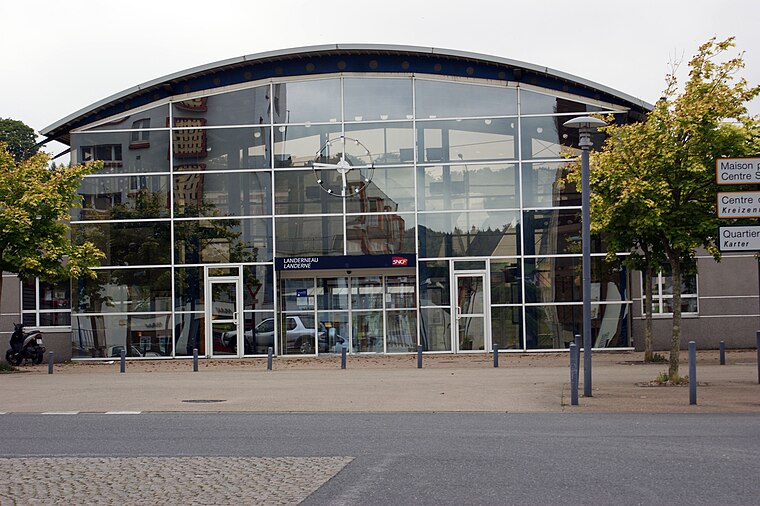
Photo: Quoique, CC BY-SA 3.0.
Landerneau station is a French railway station serving the town Landerneau, Finistère department, in western France. It is situated on the Paris–Brest railway and the branch to Quimper. Landerneau station is situated 3½ km southeast of TriGlaz.
Places in the Area
Nearby places include Landerneau.
Landerneau
Town

Photo: Fab5669, CC BY-SA 4.0.
Landerneau is a commune in the Finistère department of Brittany in north-western France. It lies at the mouth of the Elorn River which divides the Breton provinces of Cornouaille and Léon, 22 km east of Brest. Landerneau is situated 4 km southeast of TriGlaz.
TriGlaz
- Type: Factory
- Category: industry
- Location: Plouédern, Arrondissement de Brest, Finistère, Brittany, France, Europe
- View on OpenStreetMap
Latitude
48.4837° or 48° 29′ 1″ northLongitude
-4.27669° or 4° 16′ 36″ westOperator
Sotraval SPLOpen location code
8CWQFPMF+F8OpenStreetMap ID
way 955076492OpenStreetMap feature
landuse=industrialOpenStreetMap feature
man_made=works
This page is based on OpenStreetMap, Wikidata, and Wikimedia Commons.
We’d love your help improving our open data sources. Thank you for contributing.
Satellite Map
Discover TriGlaz from above in high-definition satellite imagery.
Notable Places Nearby
Highlights include Espace Steredenn and Salle de Sports.
Nearby Places
Explore places such as Laboratoires Gilbert and Les Déménageurs Bretons.
Brittany: Must-Visit Destinations
Delve into Rennes, Brest, Finistère, and Morbihan.
Curious Factories to Discover
Uncover intriguing factories from every corner of the globe.
About Mapcarta. Data © OpenStreetMap contributors and available under the Open Database License". Text is available under the CC BY-SA 4.0 license, except for photos, directions, and the map. Photo: Spendeau, CC BY-SA 3.0.