Centre d’incendie et de secours de Saint-Méard-de-Gurçon
Centre d’incendie et de secours de Saint-Méard-de-Gurçon is a fire station in Saint-Méard-de-Gurçon, Arrondissement of Bergerac, Nouvelle-Aquitaine. Centre d’incendie et de secours de Saint-Méard-de-Gurçon is situated nearby to the church Église Saint-Médard de Saint-Méard-de-Gurçon, as well as near the post office Poste Annexe.| Tap on a place to explore it |
Places of Interest Nearby
Highlights include Église Saint-Médard de Saint-Méard-de-Gurçon and Église Saint-Pierre de Ponchapt.
Église Saint-Médard de Saint-Méard-de-Gurçon
Church

Photo: Pays du Grand Bergeracois, CC BY-SA 3.0.
Église Saint-Médard de Saint-Méard-de-Gurçon is a church, which is situated 1 km north of Centre d’incendie et de secours de Saint-Méard-de-Gurçon.
Église Saint-Pierre de Ponchapt
Church

Photo: Polymagou, CC BY-SA 4.0.
Église Saint-Pierre de Ponchapt is a church, which is situated 2 km southeast of Centre d’incendie et de secours de Saint-Méard-de-Gurçon.
Église Saint-Jean de Nastringues
Church

Photo: Pays du Grand Bergeracois, CC BY-SA 3.0.
Église Saint-Jean de Nastringues is a church, which is situated 4 km southwest of Centre d’incendie et de secours de Saint-Méard-de-Gurçon.
Places in the Area
Nearby places include Nastringues and Montazeau.
Nastringues
Village
Photo: Pays du Grand Bergeracois, CC BY-SA 3.0.
Nastringues is a commune in the Dordogne department in Nouvelle-Aquitaine in southwestern France. Nastringues is situated 4 km southwest of Centre d’incendie et de secours de Saint-Méard-de-Gurçon.
Montazeau
Village
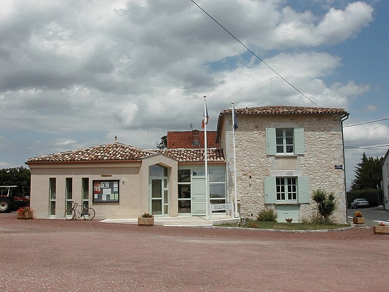
Photo: Pays du Grand Bergeracois, CC BY-SA 3.0.
Montazeau is a commune in the Dordogne department in Nouvelle-Aquitaine in southwestern France. It is fairly close to Bergerac and Bordeaux. Many of its inhabitants derive their principal income from winemaking. Montazeau is situated 4½ km west of Centre d’incendie et de secours de Saint-Méard-de-Gurçon.
Saint-Rémy
Village

Photo: Pays du Grand Bergeracois, CC BY-SA 3.0.
Saint-Rémy is a commune in the Dordogne department in Nouvelle-Aquitaine in southwestern France. Saint-Rémy is situated 5 km north of Centre d’incendie et de secours de Saint-Méard-de-Gurçon.
Centre d’incendie et de secours de Saint-Méard-de-Gurçon
- Type: Fire station
- Also known as: “CPI Saint-Méard-de-Gurçon”
- Location: Saint-Méard-de-Gurçon, Arrondissement of Bergerac, Dordogne, Nouvelle-Aquitaine, France, Europe
- View on OpenStreetMap
Latitude
44.90108° or 44° 54′ 4″ northLongitude
0.18438° or 0° 11′ 4″ eastOpen location code
8FP2W52M+CPOpenStreetMap ID
way 958284729OpenStreetMap feature
amenity=fire_station
This page is based on OpenStreetMap, Wikidata, and Wikimedia Commons.
We’d love your help improving our open data sources. Thank you for contributing.
Satellite Map
Discover Centre d’incendie et de secours de Saint-Méard-de-Gurçon from above in high-definition satellite imagery.
Notable Places Nearby
Highlights include Poste Annexe and Château le Raz.
Nearby Places
Explore places such as Lhoume Ouest and Lhoume Est.
Dordogne: Must-Visit Destinations
Delve into Périgueux, Sarlat-la-Canéda, Bergerac, and Rocamadour.
Curious Fire Stations to Discover
Uncover intriguing fire stations from every corner of the globe.
About Mapcarta. Data © OpenStreetMap contributors and available under the Open Database License". Text is available under the CC BY-SA 4.0 license, except for photos, directions, and the map. Photo: Sémhur, CC BY-SA 3.0.