Thomas P. Ryan Recreation Center
Thomas P. Ryan Recreation Center is a community center in Rochester, Rochester and Suburbs, New York which is located on Webster Avenue. Thomas P. Ryan Recreation Center is situated nearby to Sully Branch Library, as well as near the fire station RFD Engine 9.| Tap on a place to explore it |
Places of Interest Nearby
Highlights include George Eastman Museum and Main Street Armory.
George Eastman Museum
Museum

Photo: Dmadeo, CC BY-SA 4.0.
The George Eastman Museum, also referred to as George Eastman House and the International Museum of Photography and Film, is a photography museum, located on the grounds of the George Eastman's estate in Rochester, New York. George Eastman Museum is situated 1¼ miles south of Thomas P. Ryan Recreation Center.
Main Street Armory
Arts center
 The Main Street Armory is a multi-purpose arena located at 900 East Main Street in Rochester, New York. The Armory was built between 1904 and 1907 by the United States Army and was used for the training and processing of soldiers. Main Street Armory is situated 1 mile southwest of Thomas P. Ryan Recreation Center.
Memorial Art Gallery
Museum

Photo: DanielPenfield, CC BY-SA 3.0.
The Memorial Art Gallery is a civic art museum in Rochester, New York. Founded in 1913, it is part of the University of Rochester and occupies the southern half of the University's former Prince Street campus. Memorial Art Gallery is situated 1¼ miles southwest of Thomas P. Ryan Recreation Center.
Places in the Area
Nearby places include East Avenue Historic District and Browncroft Historic District.
East Avenue Historic District
Neighborhood

Photo: Tim Pierce, CC BY-SA 3.0.
East Avenue Historic District is a national historic district located at Rochester in Monroe County, New York. The district consists of a series of large 19th and early 20th century homes, houses of worship, meeting houses, and museums.
Browncroft Historic District
Neighborhood
The Browncroft Historic District is a national historic district located in the Browncroft neighborhood of Rochester, New York. The district contains 518 contributing buildings, two contributing sites, two contributing objects, and two contributing structures over 116 acres. Browncroft Historic District is situated 1½ miles southeast of Thomas P. Ryan Recreation Center.
Can of Worms
Locality
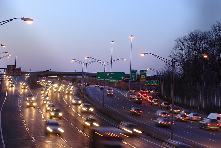 The Can of Worms is the local name for the intersection of Interstate 490, I-590, New York State Route 590, NY 96, and University Avenue on the east side of Rochester, New York, in the United States. Can of Worms is situated 2 miles southeast of Thomas P. Ryan Recreation Center.
Thomas P. Ryan Recreation Center
- Type: Community center
- Address: 530 Webster Avenue, Rochester, NY 14609
- Category: building
- Location: Rochester, Rochester and Suburbs, Finger Lakes, New York, Mid-Atlantic, United States, North America
- View on OpenStreetMap
Latitude
43.16984° or 43° 10′ 11″ northLongitude
-77.57112° or 77° 34′ 16″ westOperator
City of RochesterOpen location code
87M45C9H+WHOpenStreetMap ID
way 958546564OpenStreetMap feature
amenity=community_centreOpenStreetMap feature
building=yes
This page is based on OpenStreetMap, Wikidata, and Wikimedia Commons.
We’d love your help improving our open data sources. Thank you for contributing.
Satellite Map
Discover Thomas P. Ryan Recreation Center from above in high-definition satellite imagery.
Notable Places Nearby
Highlights include Sully Branch Library and RFD Engine 9.
Nearby Places
Explore places such as School Number 33 and 72.
Rochester and Suburbs: Must-Visit Destinations
Delve into Fairport, East Rochester, Victor, and Spencerport.
Curious Community Centers to Discover
Uncover intriguing community centers from every corner of the globe.
About Mapcarta. Data © OpenStreetMap contributors and available under the Open Database License". Text is available under the CC BY-SA 4.0 license, except for photos, directions, and the map. Photo: LtPowers, CC BY-SA 3.0.